Returning to Puerto Rico and the U.S. Virgin Islands
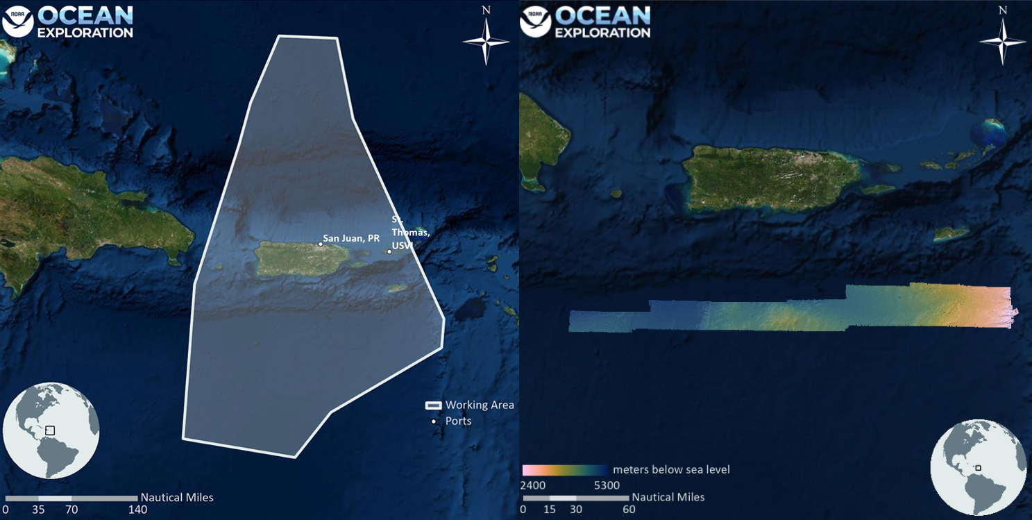
From August 25 through September 1, 2022, NOAA Ship Okeanos Explorer will be conducting remotely operated vehicle (ROV) dives in U.S. waters in the vicinity of Puerto Rico and the U.S. Virgin Islands. The original plan for this period of time, part of the third Voyage to the Ridge 2022 expedition, was to stay within the Mid-Atlantic Ridge region. However, unexpected logistical circumstances meant that operations along the Mid-Atlantic Ridge had to be cut short so that the ship could return to port.
The exploration and mapping that will now take place during the Puerto Rico and U.S. Virgin Islands portion of this expedition is a testament to the adaptability and flexibility of ship-based and onshore scientists, and of the system of telepresence-enabled exploration in general. Once the call was made to return to San Juan for a temporary port-stop, scientists mobilized to work together to propose, discuss, and decide on new priority dive targets in the region within a very short period of time.
Luckily, the ship has a rich history in the region, including ROV explorations of the region in 2015 and also in 2018, and mapping expeditionsearlier this year, from which both scientists and the public can draw on to get a sense of what is to come. Below, take a look at some of the highlights of past ocean exploration aboard NOAA Ship Okeanos Explorer in the area.
A Sea Star Not Seen for Over a Century
Video Player is loading.
Current Time 0:00
/
Duration -:-
Loaded: 0%
0:00
Stream Type LIVE
Remaining Time --:-
1x
Chapters
descriptions off, selected
captions settings, opens captions settings dialog
captions off, selected
English
Captions
This is a modal window.
Beginning of dialog window. Escape will cancel and close the window.
End of dialog window.
A 2015 remotely operated vehicle dive on the east wall of Mona Canyon revealed a creature that had not been seen for over 130 years. The six-armed sea star Laetmaster spectabilis, which was observed on hard substrate at around 3,900 meters depth, had only been documented once before: at the time of its original description in the late 1800s. Video courtesy of NOAA Ocean Exploration, Océano Profundo 2015.Download largest version (mp4, 13.9 MB).
A Species New to Science, Described Entirely by Video Data
Video Player is loading.
Current Time 0:00
/
Duration -:-
Loaded: 0%
0:00
Stream Type LIVE
Remaining Time --:-
1x
Chapters
descriptions off, selected
captions settings, opens captions settings dialog
captions off, selected
This is a modal window.
Beginning of dialog window. Escape will cancel and close the window.
End of dialog window.
On the same expedition, at a depth 3,900 meters (12,795 feet), scientists encountered three comb jellies that were different from any known species. The sighting pre-dated sampling operations on NOAA Ship Okeanos Explorer, so collection wasn’t an option. In place of a specimen, the scientists used video captured during the expedition, the only evidence of this animal’s existence, to establish that it was indeed new to science and to formally describe and name it: Duobrachium sparksae. This marked the first time NOAA relied exclusively on video to designate a new genus and species. Video courtesy of NOAA Ocean Exploration, Océano Profundo 2015.Download largest version (mp4, 13.8 MB).
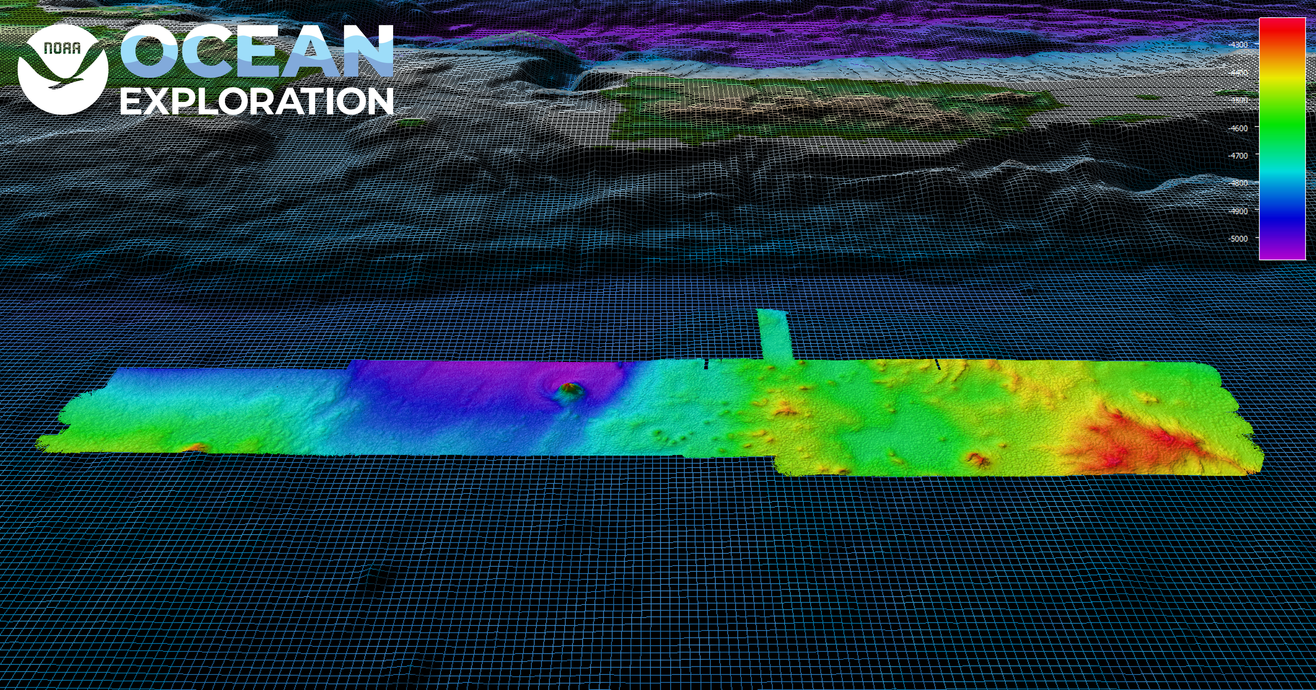
Detailed Mapping within the Region
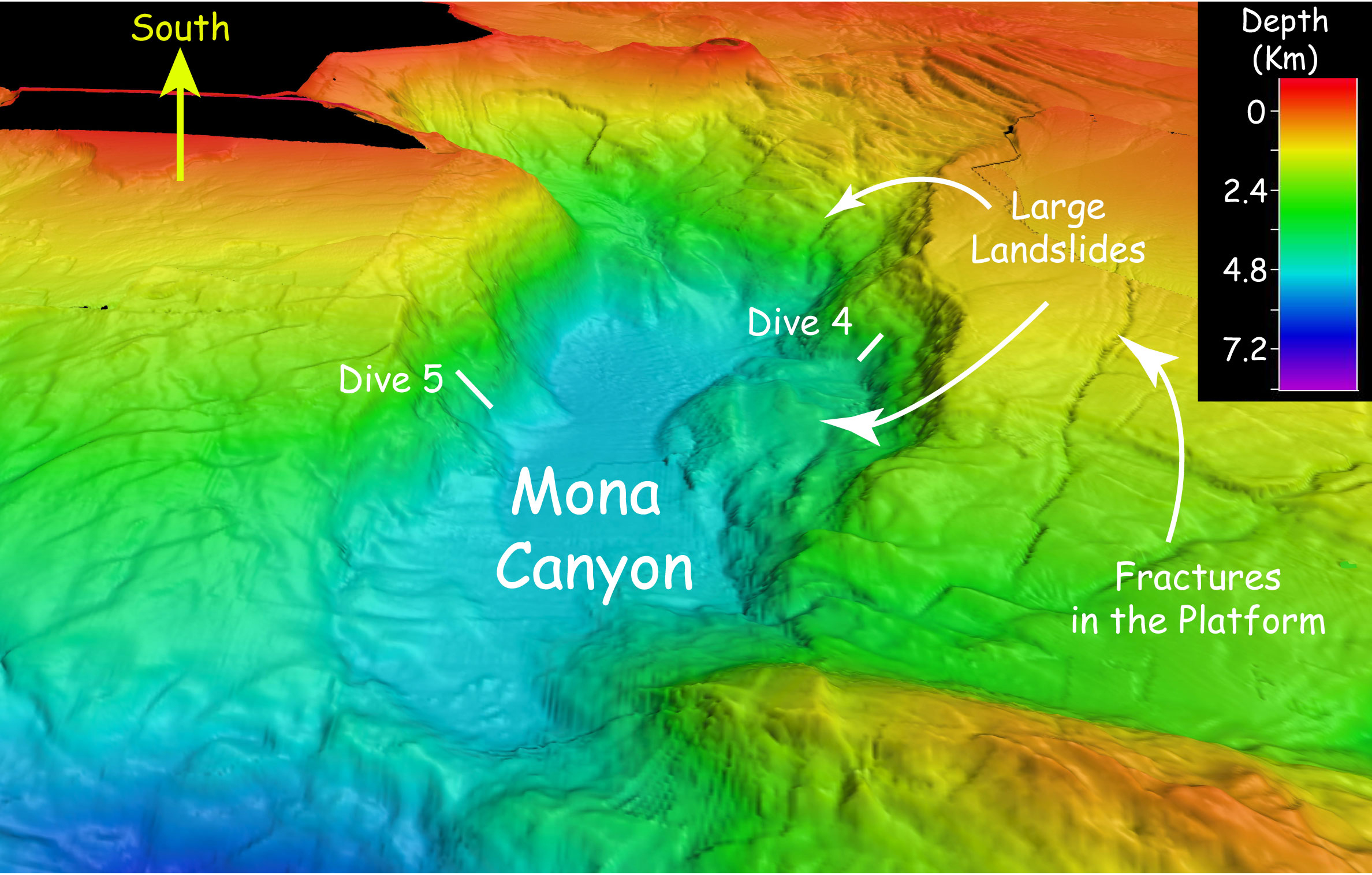
In March 2022, NOAA Ocean Exploration conducted an exploratory ocean mapping expedition focused on U.S. deep waters south of Puerto Rico. The team mapped a total of 8,398 linear kilometers (5,218 miles) and 18,580 square kilometers (7,174 square miles) of seafloor, an area approximately twice the size of Puerto Rico. These mapping efforts resulted in the collection of high-resolution data needed to fill critical mapping gaps in the region and revealed never-before seen morphologic features of the seafloor south of Puerto Rico, including small seamounts. Image courtesy of NOAA Ocean Exploration, 2022 Caribbean Mapping.Download largest version (jpg, 532 KB).
In order to better prepare for and to increase our ability to predict marine hazard events like earthquakes, underwater landslides, and tsunamis, we must first better understand these hazards. We can do that by mapping the features, for a large-scale understanding, and by getting eyes on the seafloor through tools like the video imagery provided by remotely operated vehicles, to better understand the geologic setting in which these events occurred. To learn more, check out this excellent essay on conducting geohazard research and this one on tectonic activity in the area.
Multibeam sonar bathymetry of Mona Canyon, off the northwest coast of Puerto Rico, showing large landslides that might be related to the 1918 magnitude-7.3 earthquake. Image courtesy of NOAA Ocean Exploration, Océano Profundo 2015.Download largest version (jpg, 1 MB).
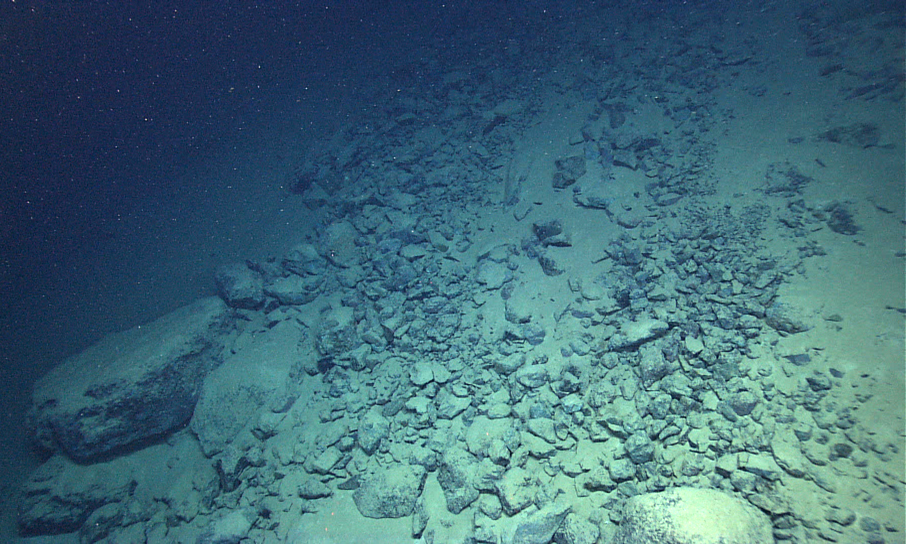
On November 2, 2018, we dove in Buck Island Reef National Monument and surrounding waters, approximately four miles north of St. Croix in the Caribbean Sea. This was the deepest dive ever conducted inside the monument, and provided “an expansion of knowledge” about biodiversity within the monument. This kind of exploration of deep-water habitats and resources within protected areas provides crucial information to park managers.
Video Player is loading.
Current Time 0:00
/
Duration -:-
Loaded: 0%
0:00
Stream Type LIVE
Remaining Time --:-
1x
Chapters
descriptions off, selected
captions settings, opens captions settings dialog
captions off, selected
English
Captions
This is a modal window.
Beginning of dialog window. Escape will cancel and close the window.