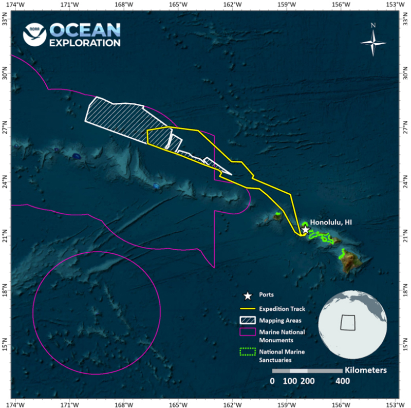
This map shows the general operating area during the Beyond the Blue: Papahānaumokuākea Mapping 1 expedition, with the approximate track of NOAA Ship <i>Okeanos Explorer</i> into Papahānaumokuākea Marine National Monument shown as a yellow line, mapping targets shaded in white, and the boundaries of marine national monuments shown in purple.
Operations Map
Image courtesy of NOAA Ocean Exploration, 2024 Beyond the Blue. Download larger version (jpg, 385 KB).

This map shows the general operating area during the Beyond the Blue: Papahānaumokuākea Mapping 1 expedition, with the approximate track of NOAA Ship Okeanos Explorer into Papahānaumokuākea Marine National Monument shown as a yellow line, mapping targets shaded in white, and the boundaries of marine national monuments shown in purple.

Learn more