Characterizing Variability in Pacific Northwest Methane Seeps Using a Fleet of Small AUVs
August 11-13, 2023
July 23-31, 2024
Research Vessel Rachel Carson (RC 101)
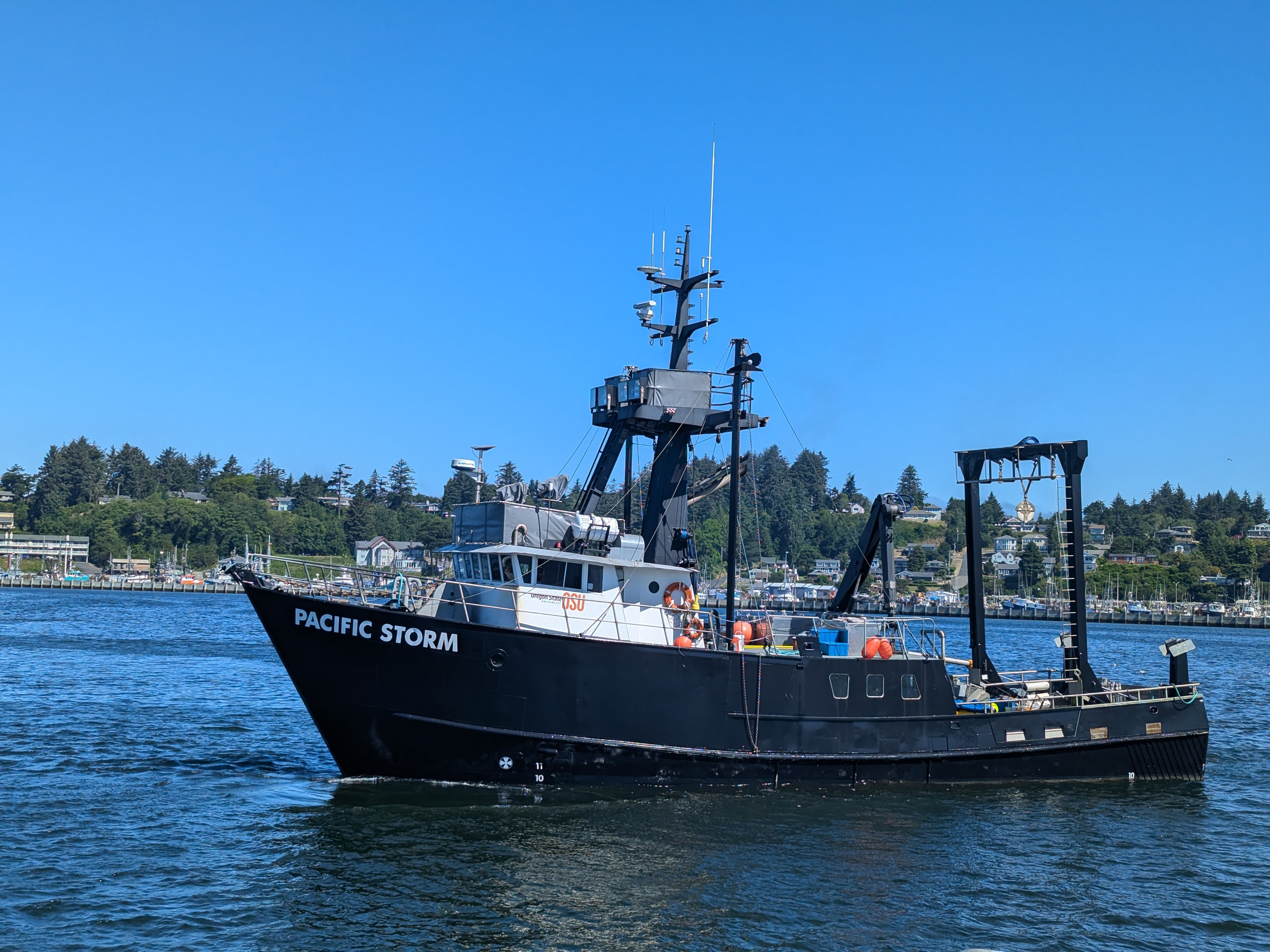
Research Vessel Pacific Storm
Off the Coast of Washington
Off the Coast of Oregon
Develop and demonstrate an approach to efficiently and effectively map and characterize methane seeps over wide areas
Autonomous underwater vehicles, sonar, CTD
Expedition Summary (Year One)
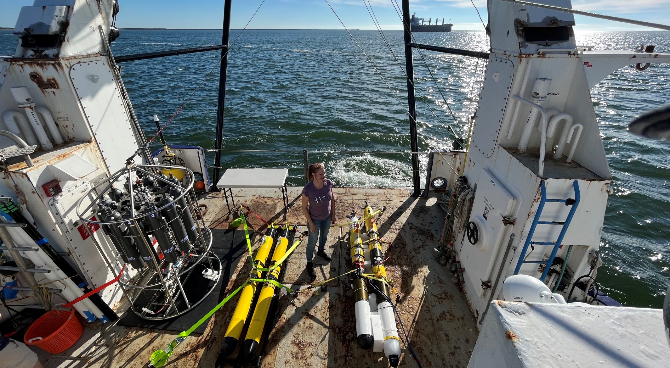
From August 11 to 13, 2023, a team of researchers visited known methane seeps off the coast of Washington to test their new approach to mapping and characterizing methane seeps over wide areas. With easily deployable and relatively inexpensive autonomous underwater vehicles (AUVs) equipped with imaging sonars and custom sensors, they successfully located and mapped seeps and measured associated bubbles and dissolved methane right at their source and up through the water column.
Why Explore Methane Seeps?
Methane is a potent greenhouse gas, and it's released into the ocean from the seafloor as gas bubbles via methane seeps. Despite the prevalence of seeps along continental margins, data is limited, and their impacts on the ocean and atmosphere, both positive and negative, are largely unknown. To improve our understanding of these emissions, how they influence life on the seafloor and in the water column as well as their role in the global carbon cycle, high-resolution, close-up acoustic data focused at the seafloor source and co-located physical and chemical data from a variety of seeps, at a variety of depths, are needed.
Searching for and Sampling Methane Seeps
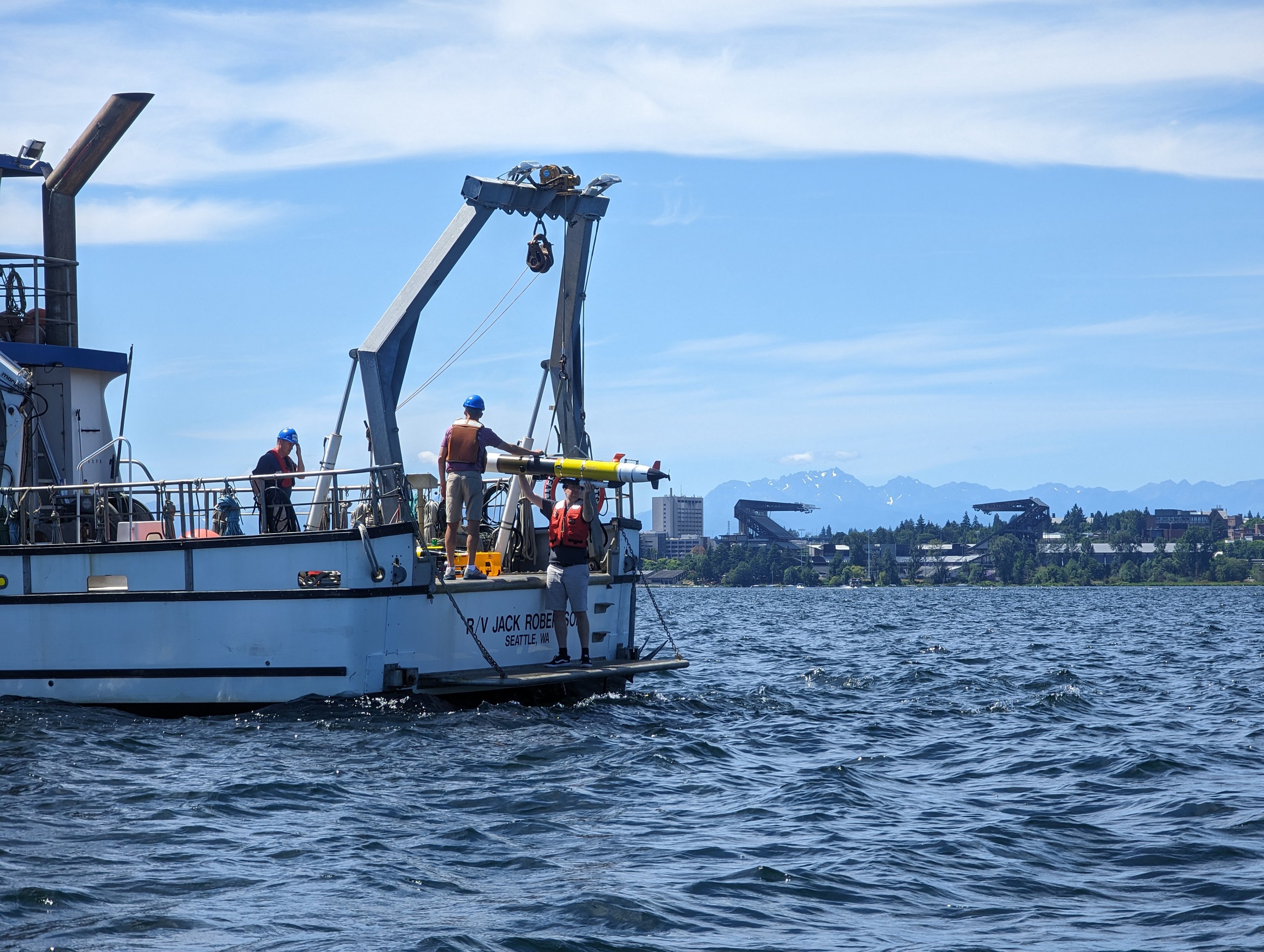
To collect these data, this research team is developing new robotic sampling techniques using AUVs with advanced capabilities that eventually will be able to search for and intensively sample seeps without human involvement.
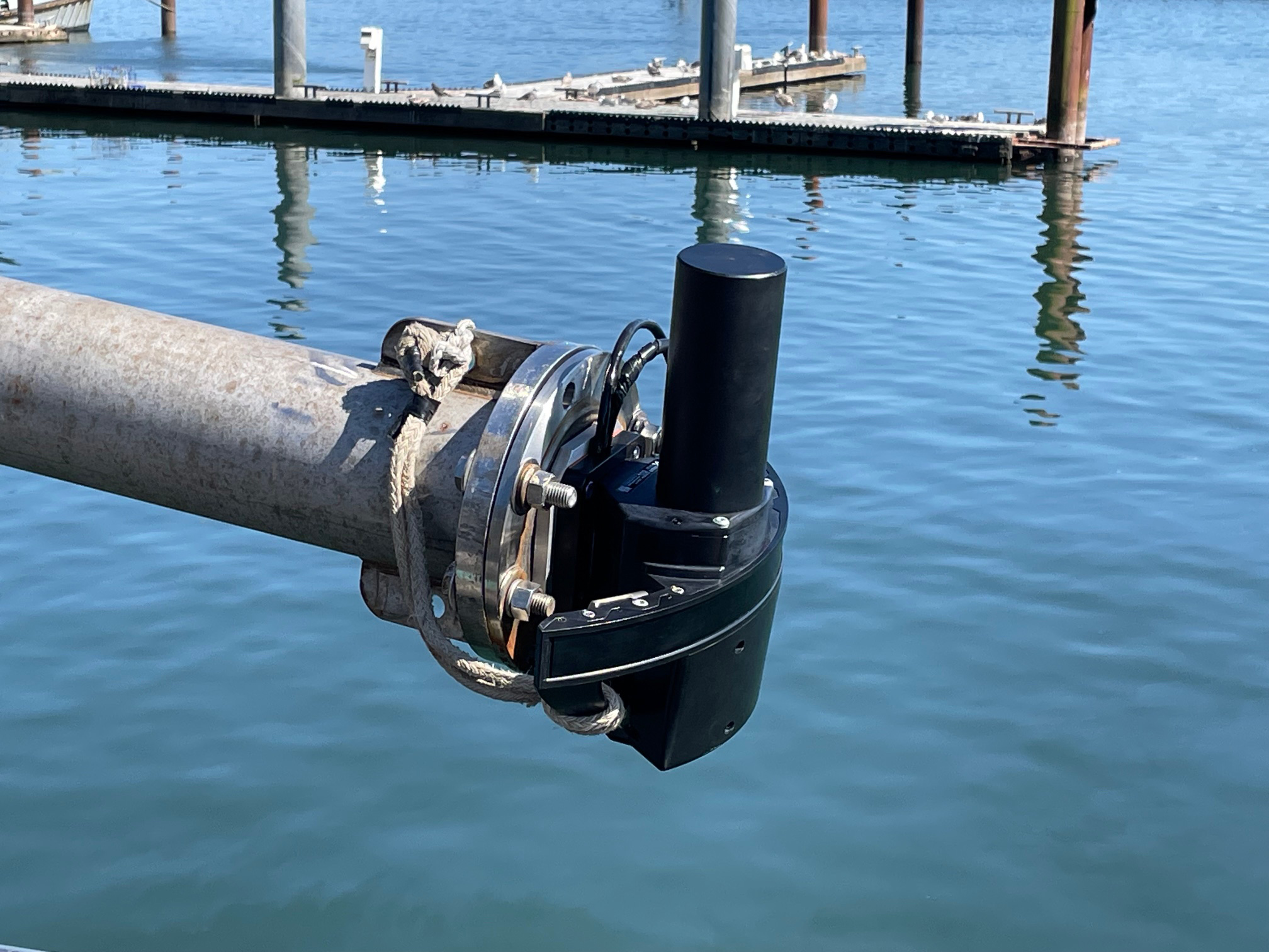
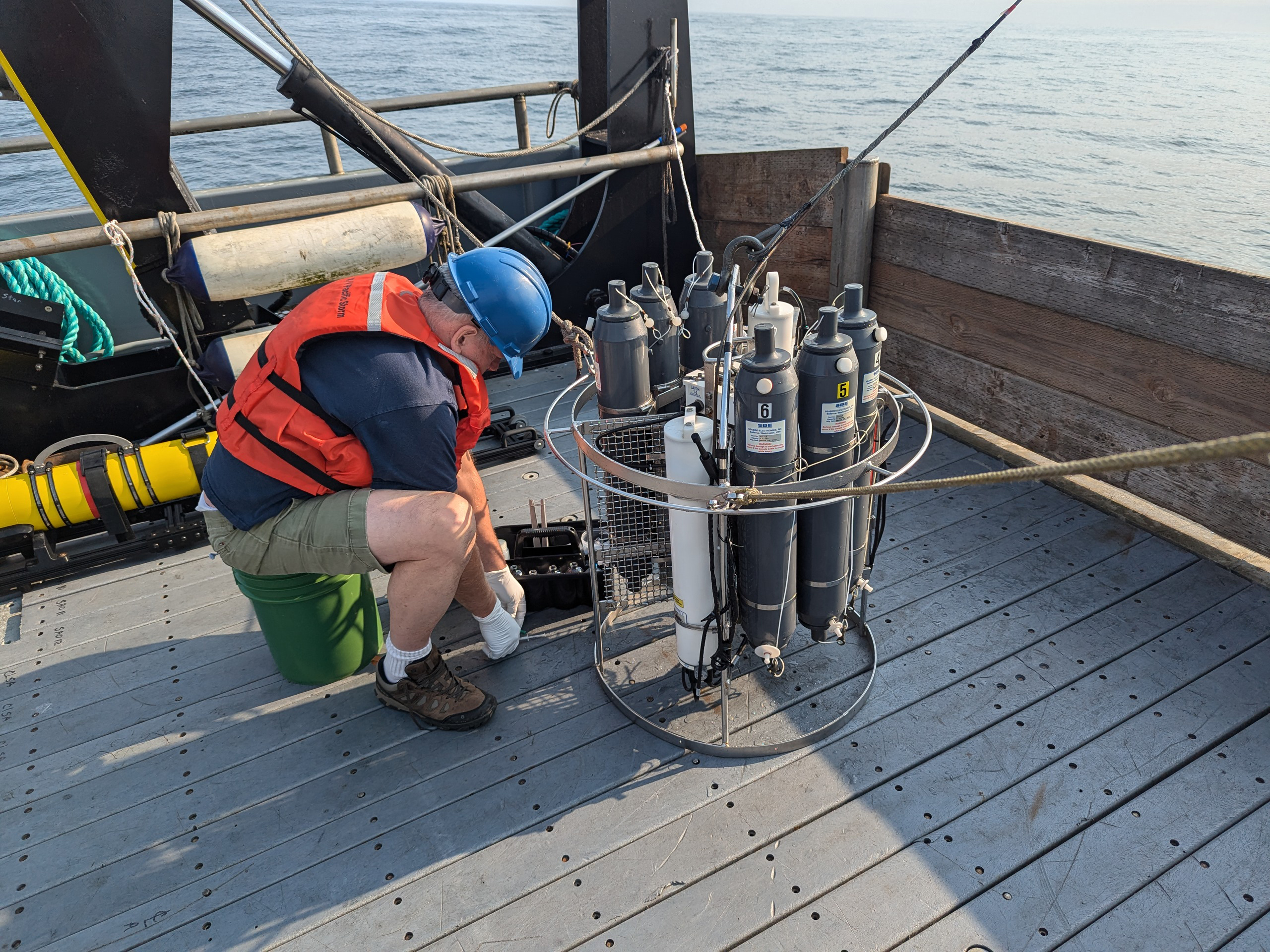
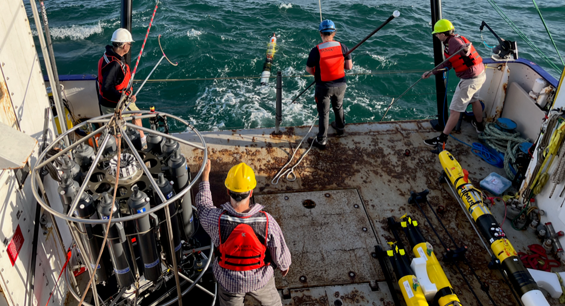
During this expedition, they used a combination of traditional (shipboard) and novel (AUVs) sampling tools to achieve their goals. Among the most important tools were the acoustic sonars. To make sure the data collected by the shipboard and AUV sonars were accurate in relation to each other, the team calibrated them with an artificial bubble source (a dive tank) in the controlled environment of Seattle’s Lake Washington before heading out to deeper waters.

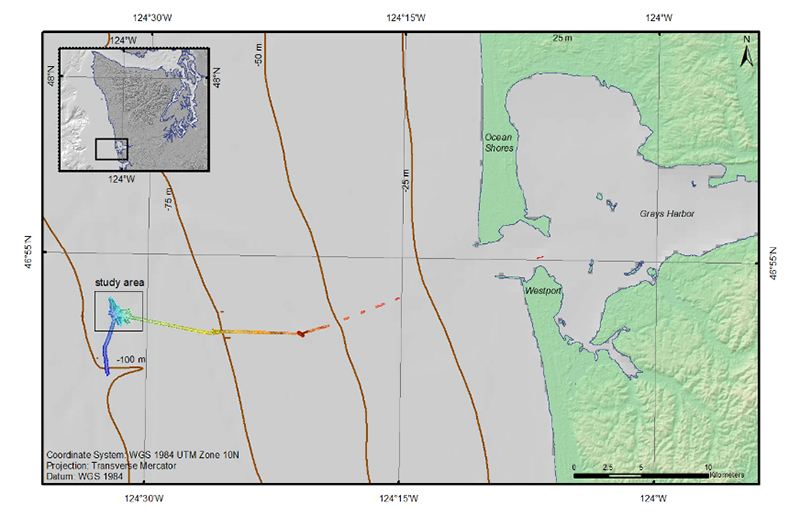
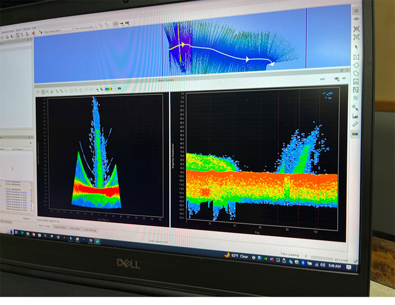
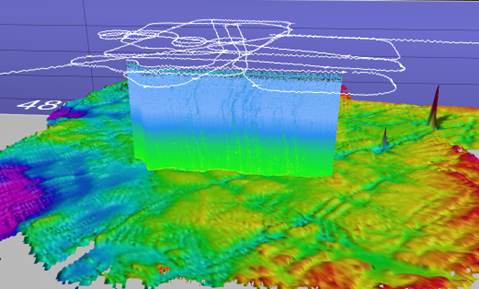
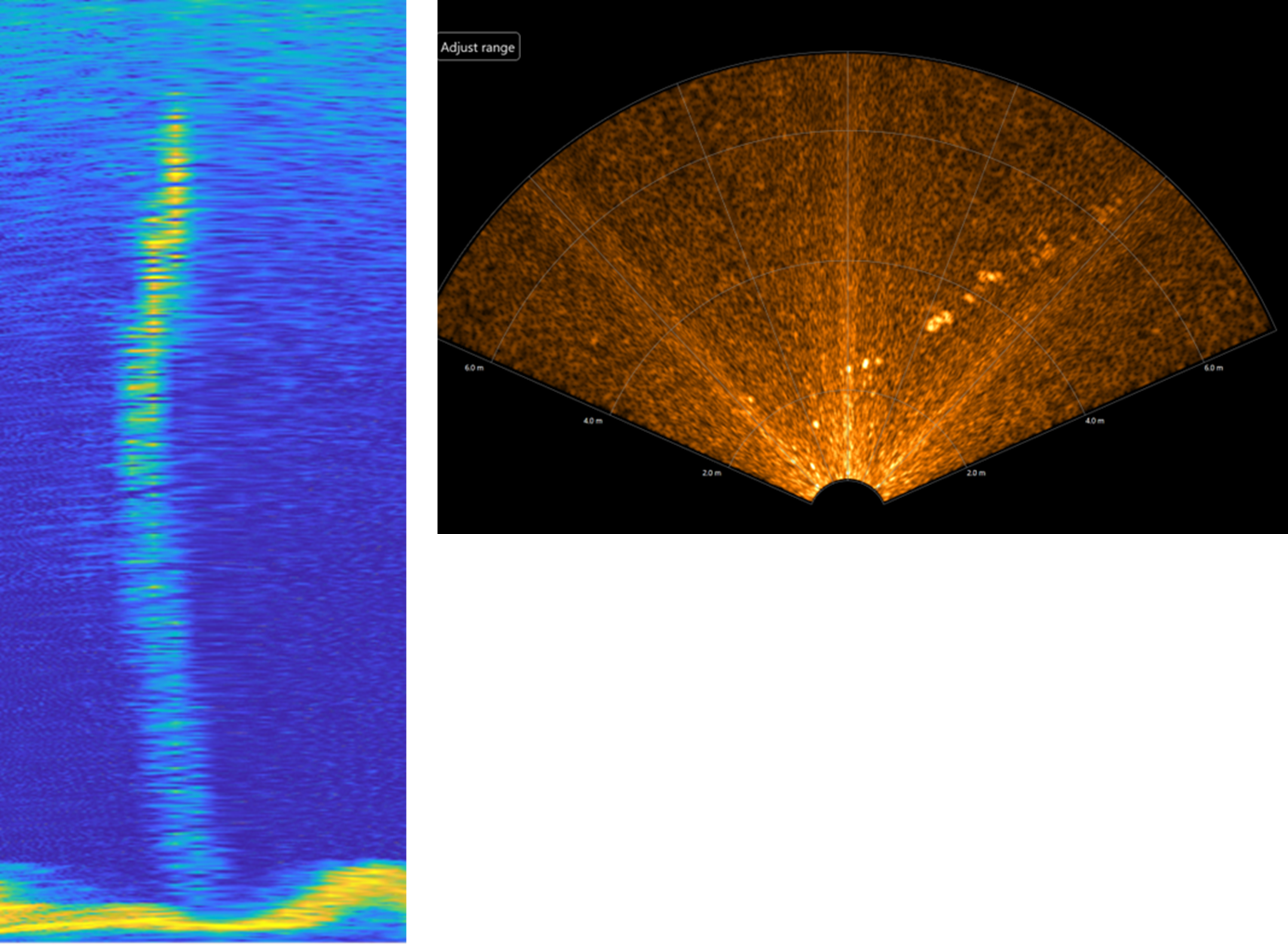
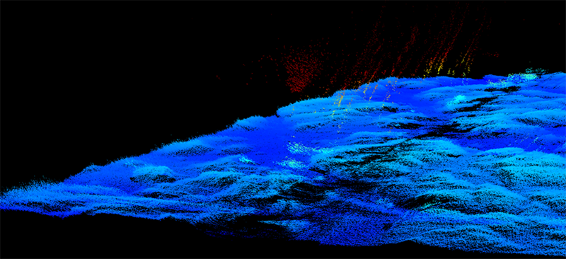
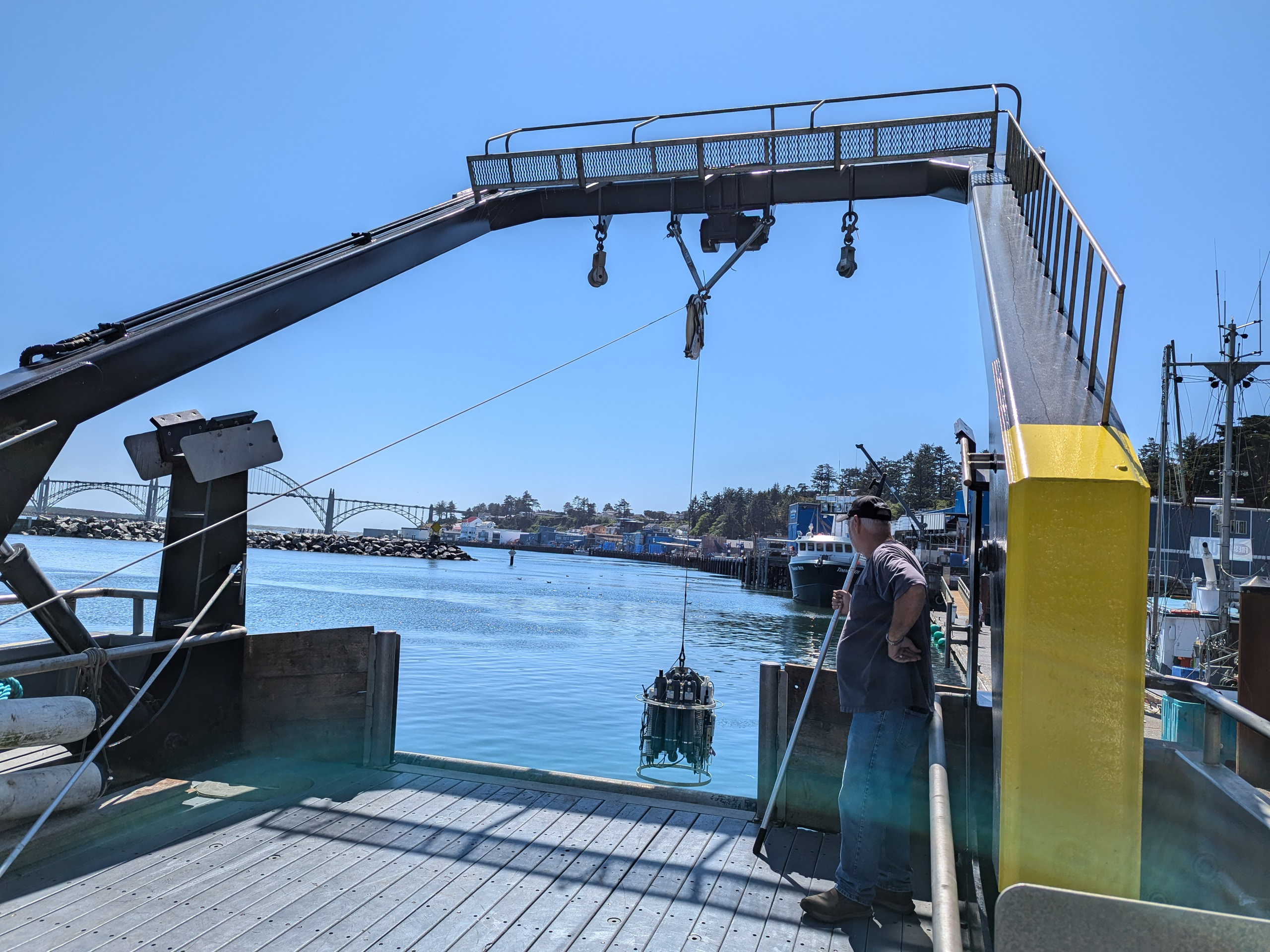
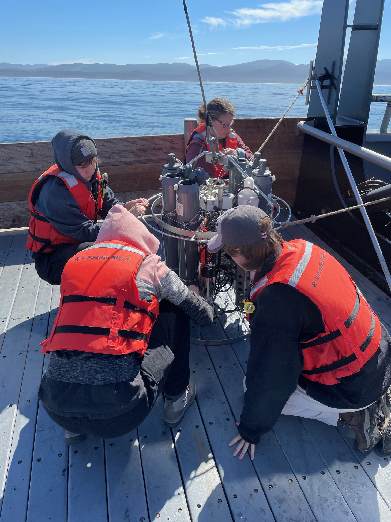
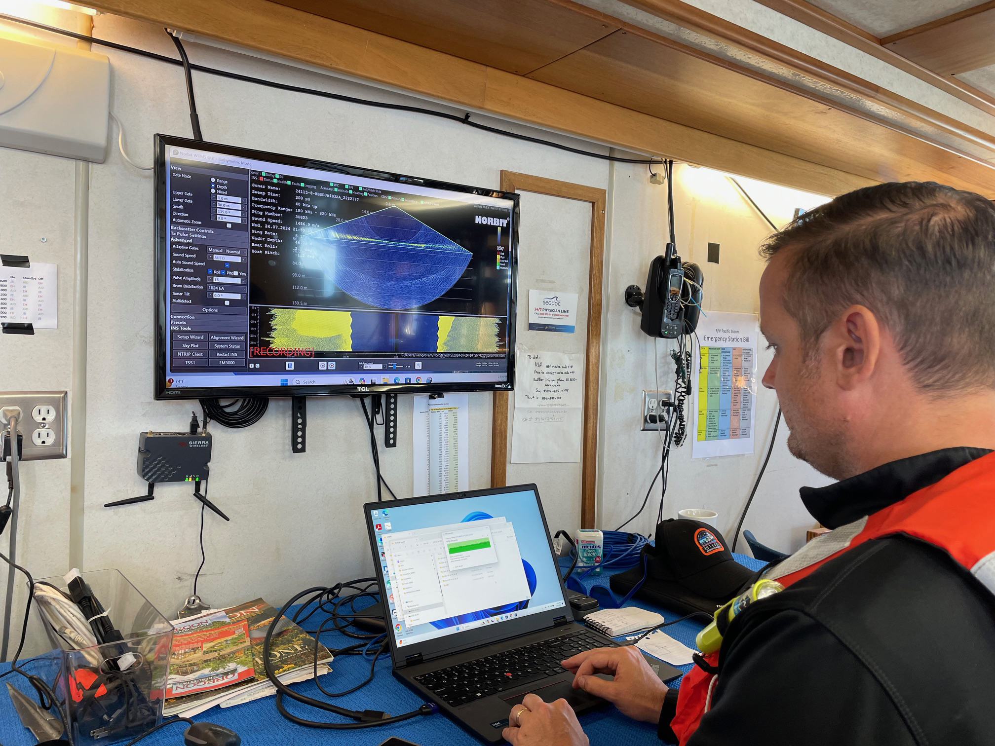
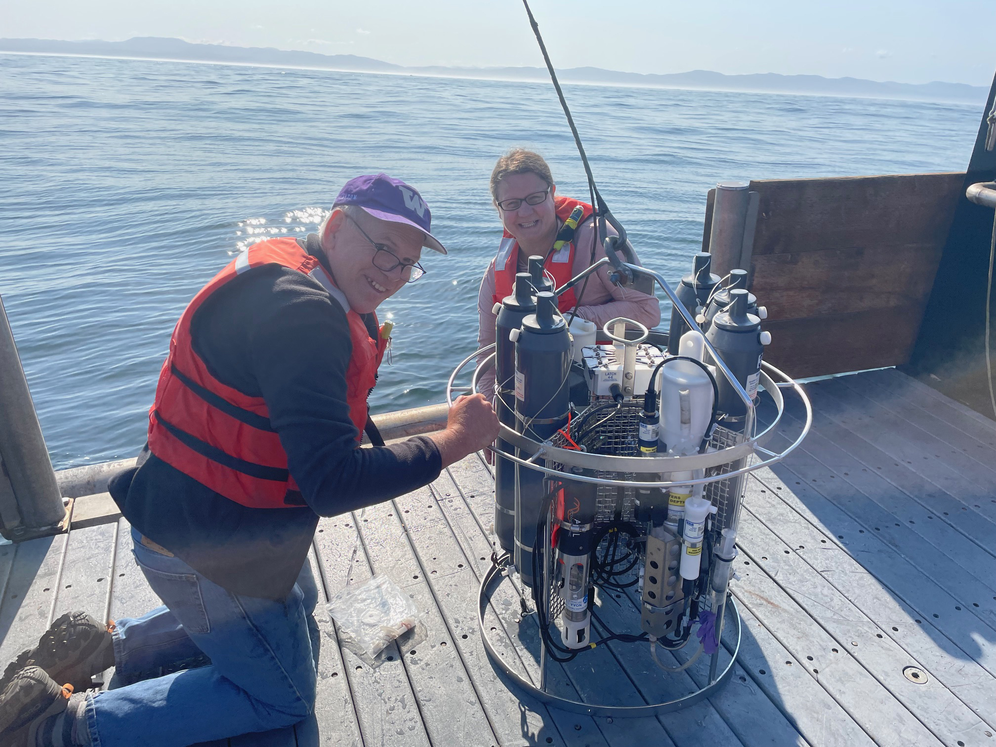
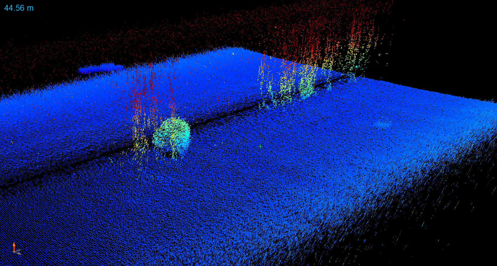
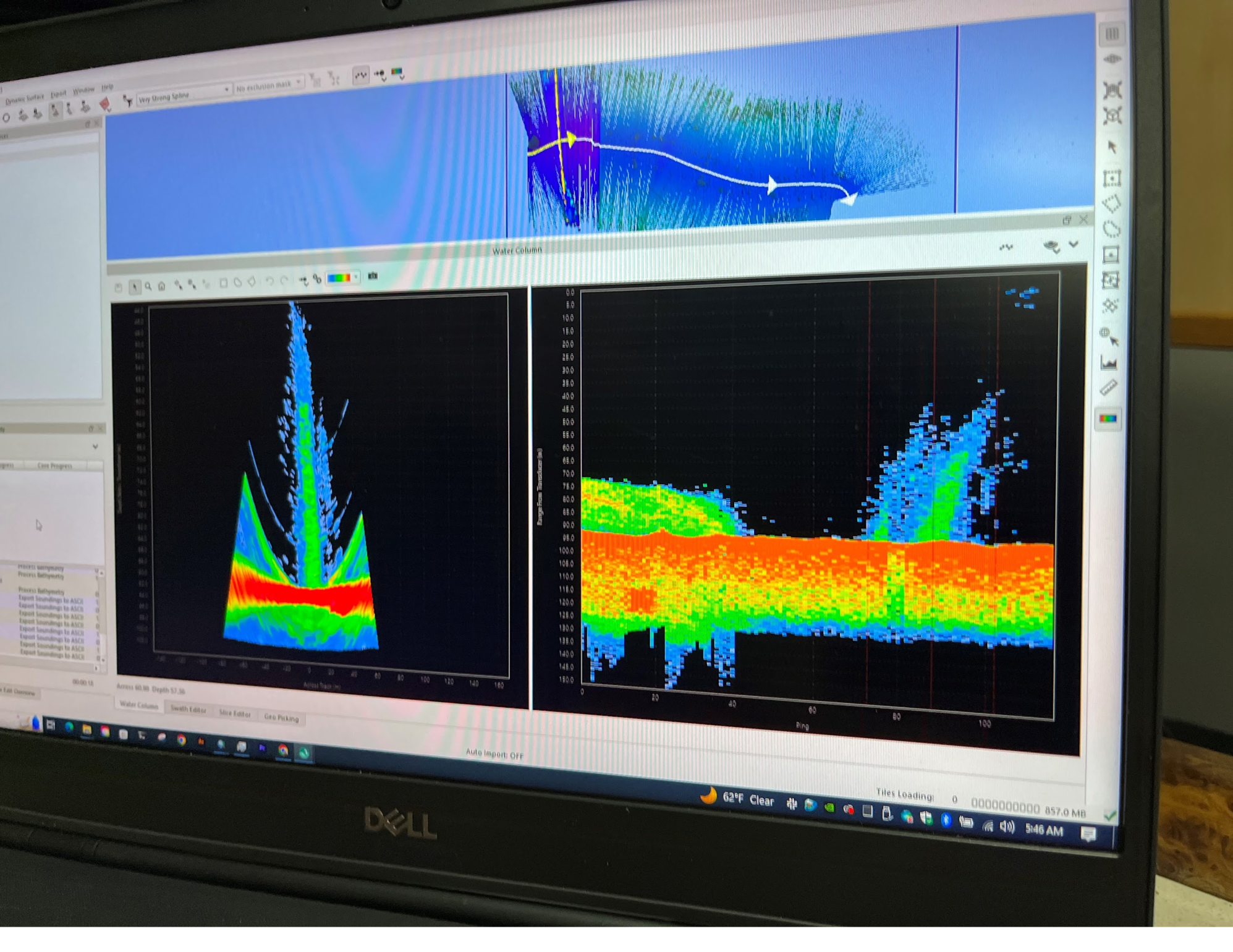
Once at sea, with a storm on its way, the team went right to work, targeting an area with previously reported seeps. At night, researchers surveyed the area for seeps using a shipboard pole-mounted multibeam sonar and a CTD (conductivity, temperature, depth) rosette. Their survey showed a surprisingly large and intense seep that they nicknamed "Mondo."
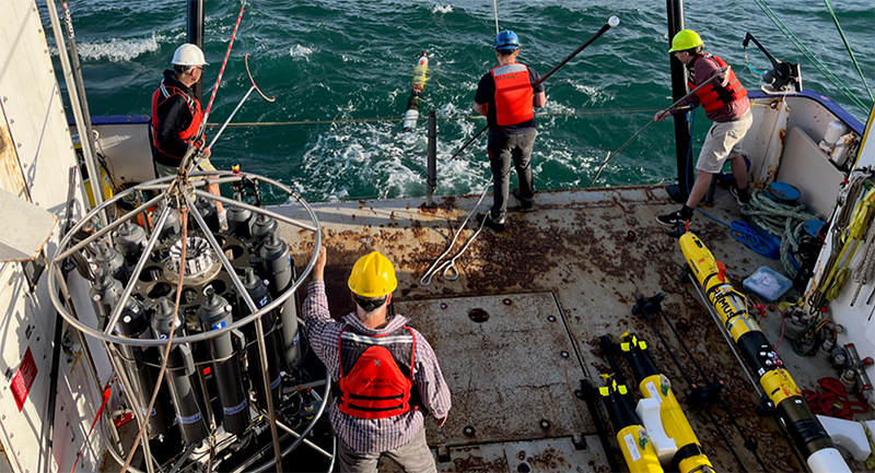
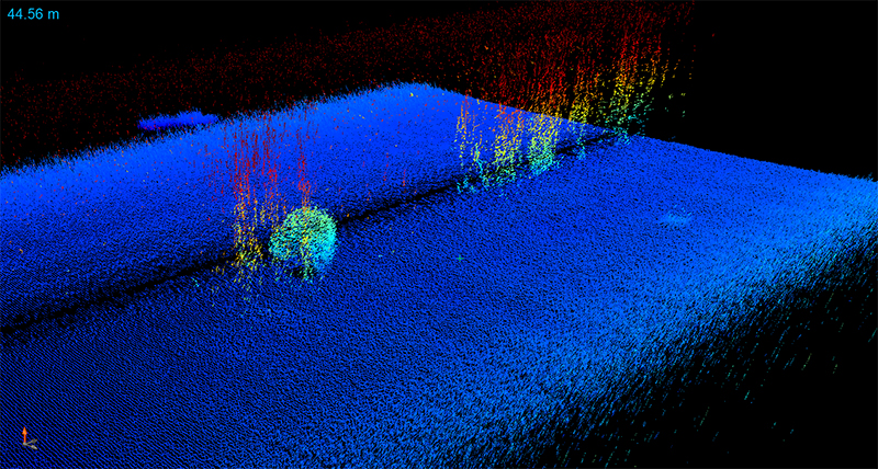
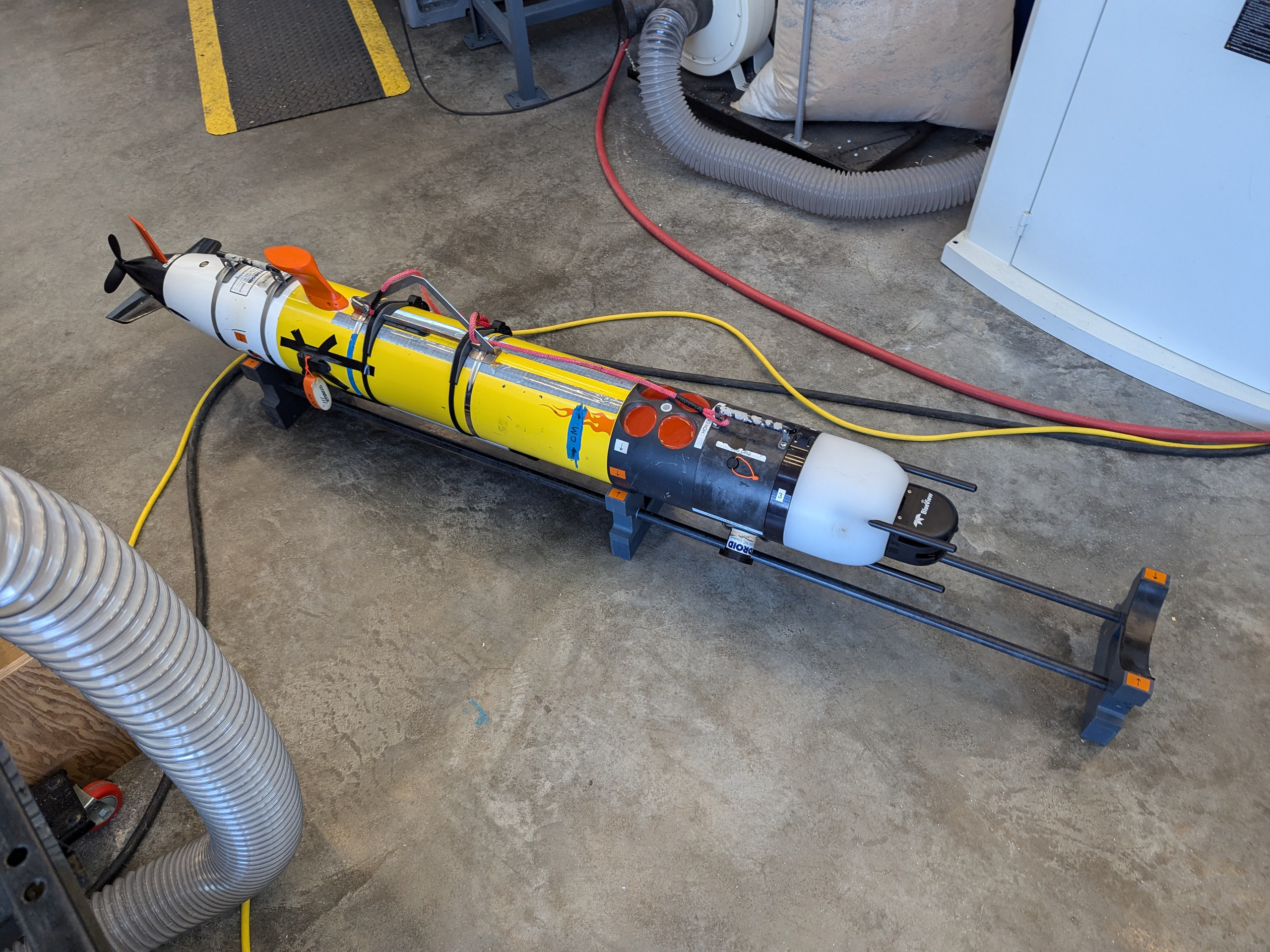
Information about Mondo was shared with the dayshift, who then deployed the small-class AUVs to study it more closely. They used Virginia Tech 690 AUVs with 3D side-scan sonar to locate the seep and commercially available REMUS 100 AUVs with a high-resolution forward-looking sonar and custom sensors to perform more intensive in situ sampling (e.g., measure bubbles and dissolved methane). Together, the AUVs were able to locate the bubble plume and then sample the water in and around it. It's much easier to sample a seep in situ with an AUV than with a CTD rosette dangling from a ship. And, the close-up acoustic data collected by the AUVs is more accurate than those data collected by shipboard sonars, which may be hundreds of feet from a seep's source.
Mondo wasn't the only seep in the area, or the only one visited, but it had the strongest signal, which made it a good target for testing of the AUVs.
Next Steps
Back on shore, the team will synthesize the data and estimate seep emissions and analyze water samples collected with the shipboard CTD rosette. Outcomes from this expedition will inform ongoing development of the AUVs and their suite of tools, which will be further tested during additional lake tests and a second expedition planned for 2024 targeting deeper seeps.
Expedition Summary (Year Two)
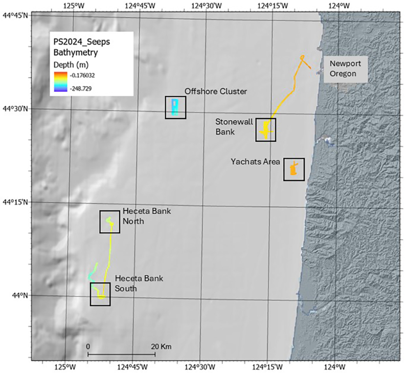
For the second summer in a row, a team of researchers set out to test their new approach to mapping and characterizing methane seeps, this time on Research Vessel Pacific Storm off the coast of Oregon. Following last year’s successful expedition, and after a year of processing and analyzing data and adjusting their approach accordingly, the team returned to sea, visiting five known methane seep sites, but finding active seepage at only two of them.
Searching for Seeps
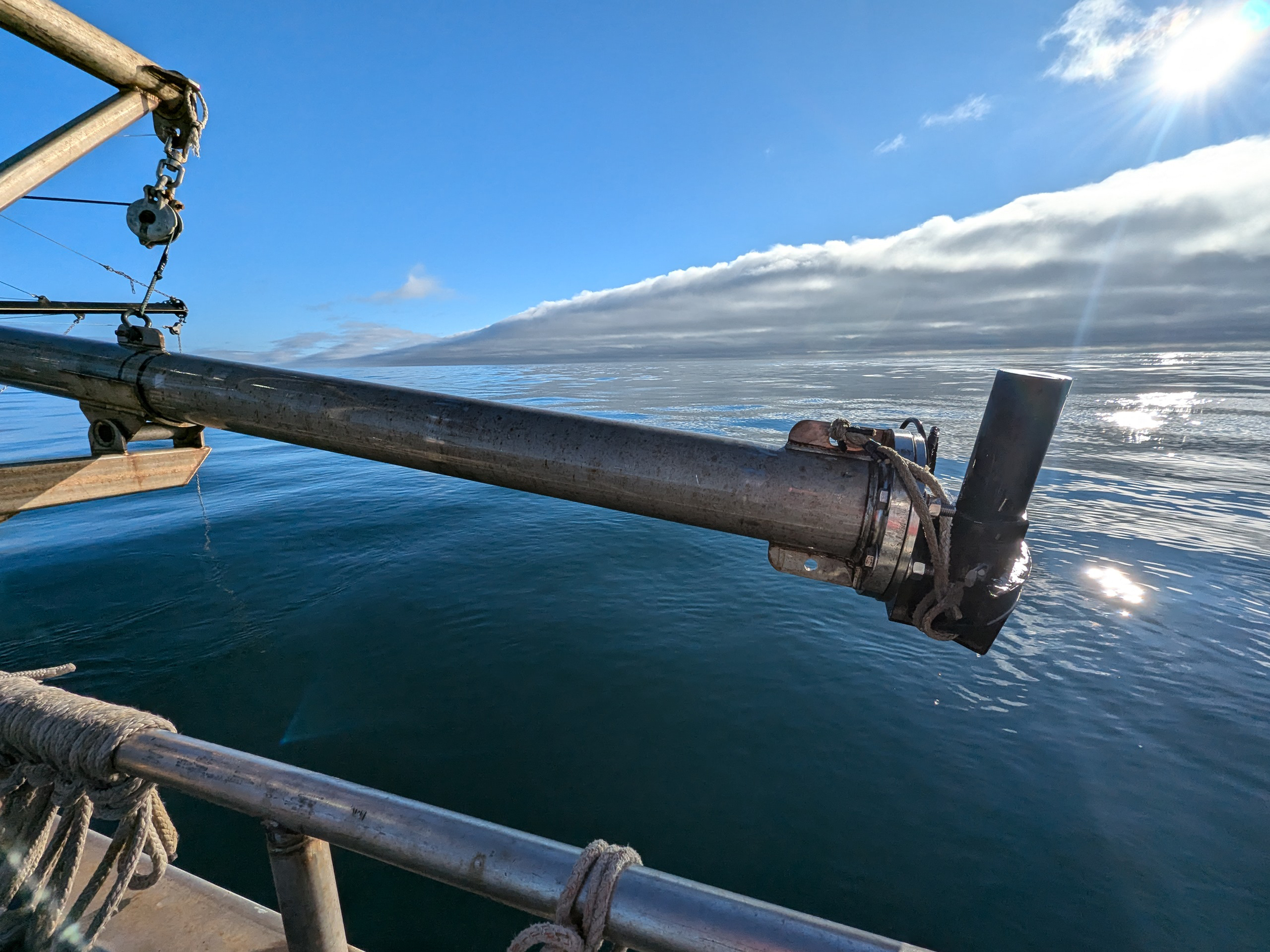
This year’s expedition was conducted in two parts between July 23 and July 31, 2024. During the first part, the team used two technologies to search for evidence of seep activity and lay the groundwork for exploration with autonomous underwater vehicles (AUVs). In an area where a big cluster of seeps was seen in 2018, they used a shipboard pole-mounted multibeam sonar to map the seafloor and search for bubble plumes in the acoustic water column backscatter data and a CTD (conductivity, temperature, depth) rosette to collect oceanographic data and water samples. However, they didn’t find any signs that these seeps were still seeping — an interesting finding that indicates they change over time.
Deploying the AUVs
For the second part of the expedition, the team brought the AUVs, targeting known seep sites on Heceta Bank — an area known for having abundant seepage — and hoping for the best. They found two sites with active seeps, and deployed the CTD and AUVs at the larger of the two, where vigorous bubbling was occurring at a shallow enough depth for the gas to potentially reach the atmosphere (approximately 40 meters/131 feet in spots). Once again they used Virginia Tech 690 AUVs and REMUS 100 AUVs. They used the 690 AUVs to locate the seeps and then the REMUS 100s to sample and further characterize them.
What Comes Next
With the two expeditions now behind them, the team will wrap up the project by processing, analyzing, and interpreting the data from this year’s expedition and comparing it to the seep data they collected during last year’s expedition. Preliminarily, both sites are in roughly 90 meters (295 feet) of water and consist of a cluster of seeps. However, last year's cluster had one large seep (nicknamed “Mondo”); this year’s did not have any large seeps.
Ultimately, this project will improve our understanding of how methane from these seeps impacts the ocean and atmosphere, both positively and negatively. It will also deliver a new and proven way to explore and characterize — and potentially discover — methane seeps.
Images
Exploration Team
Craig McNeil
Principal Investigator
Tamara Baumberger
Co-Principal Investigator
Jeff Beeson
Co-Principal Investigator
Dan Stilwell
Co-Principal InvestigatorEducation Content
Education theme pages provide the best of what the NOAA Ocean Exploration website has to offer to help educators in the classroom incorporate this project into their curriculum. Each theme page includes expedition features, lessons, multimedia, career information, and associated past projects and expeditions.


Related Links
- Exploration Tools: Autonomous Underwater Vehicles | Sonar | CTD | Research Vessel Rachel Carson, Research Vessel Pacific Storm
- Ocean Fact: What is the difference between cold seeps and hydrothermal vents?
- Expedition: Gradients of Blue Economic Seep Resources
- News: Seafloor Mapping Data Reveals Large Number of Gas Seeps Off U.S. West Coast
- Additional project information
- Research Vessel Pacific Storm
Partners
- University of Washington Applied Physics Laboratory
- Virginia Tech Bradley Department of Electrical and Computer Engineering
- Oregon State University/NOAA Cooperative Institute for Marine Ecosystem and Resources Studies
- University of Washington/NOAA Cooperative Institute for Climate, Ocean, and Ecosystem Studies
- NOAA Pacific Marine Environmental Laboratory
- Oregon State University Marine Mammal Institute
Media Contact
Emily Crum
Communications Specialist
NOAA Ocean Exploration
ocean-explore-comms@noaa.gov
Funding for this expedition was provided by NOAA Ocean Exploration via its Ocean Exploration Fiscal Year 2022 Funding Opportunity.
Published November 2, 2023
Last Updated March 18, 2025