Exploring Deep-Sea Methane Seeps Along the Chile Margin
Dates
October 11 - December 5, 2024
Vessel
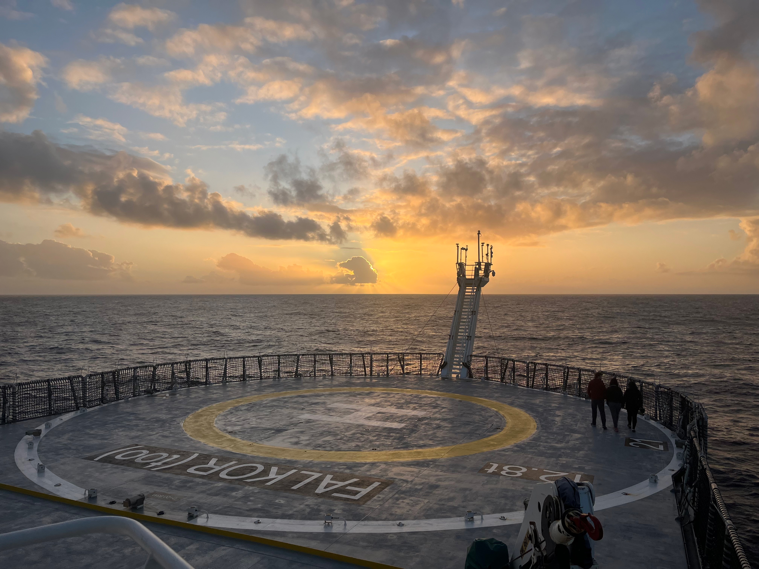
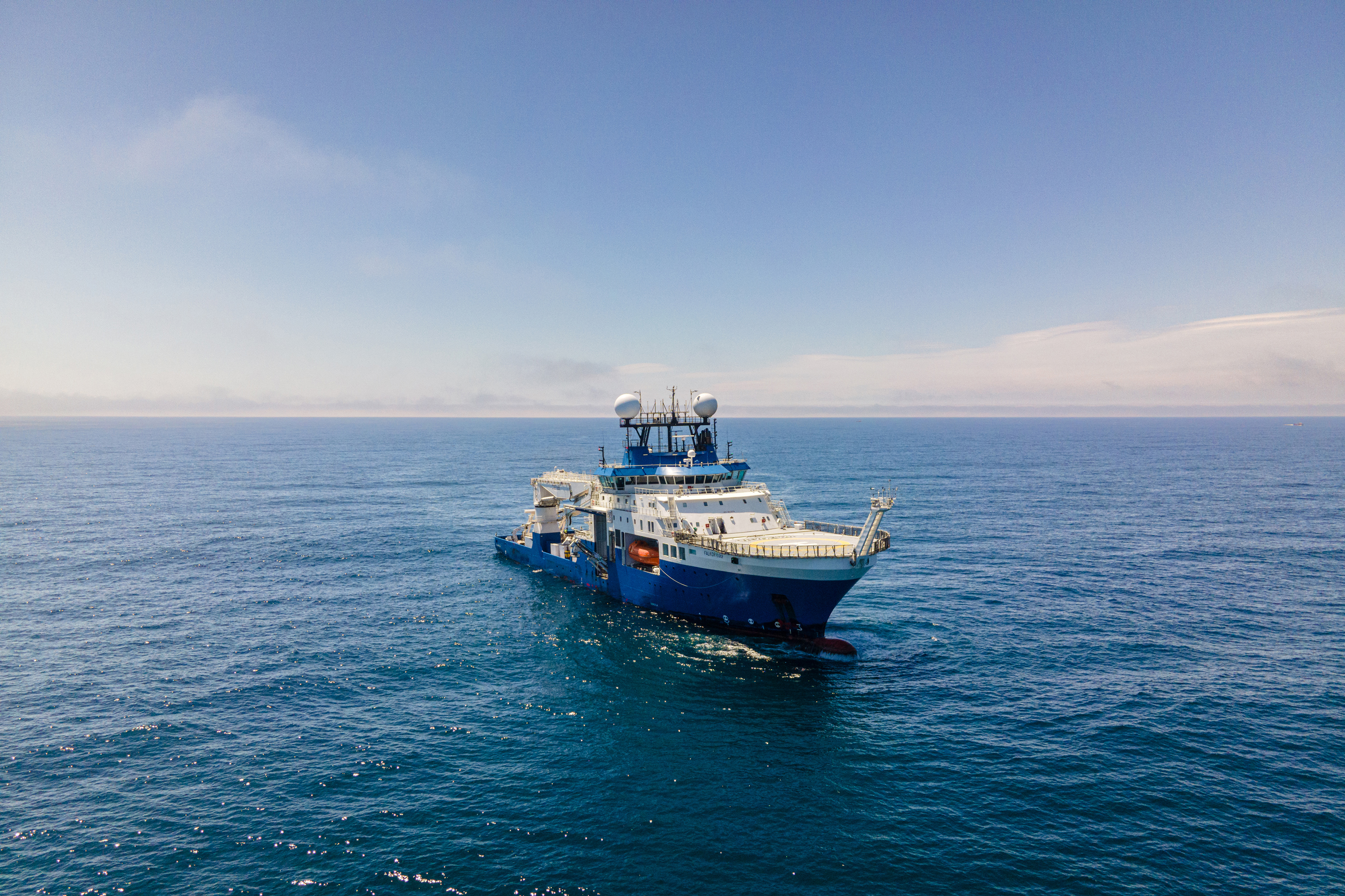
Research Vessel Falkor (too)
Location
Pacific Ocean: Off Chile
Primary goal
Search for, explore, and characterize methane seeps along the coast of Chile
Primary technologies
Sub-bottom profiler, remotely operated vehicle, methane sensor, sediment coring devices, multibeam sonar
Project Summary
From October 11 to December 5, 2024, an interdisciplinary and international team of researchers explored the unique geological and biological systems of the Chile margin during an ambitious expedition on Schmidt Ocean Institute’s Research Vessel Falkor (too) . With support from NOAA Ocean Exploration, one of the expedition projects focused on collecting data to unravel the complexities of methane seep systems — a type of cold seep and a significant contributor to oceanic carbon cycling — in this tectonically active region.
Project Details
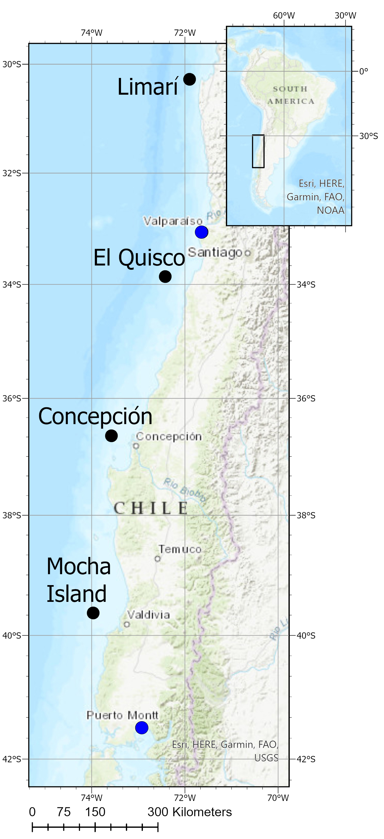
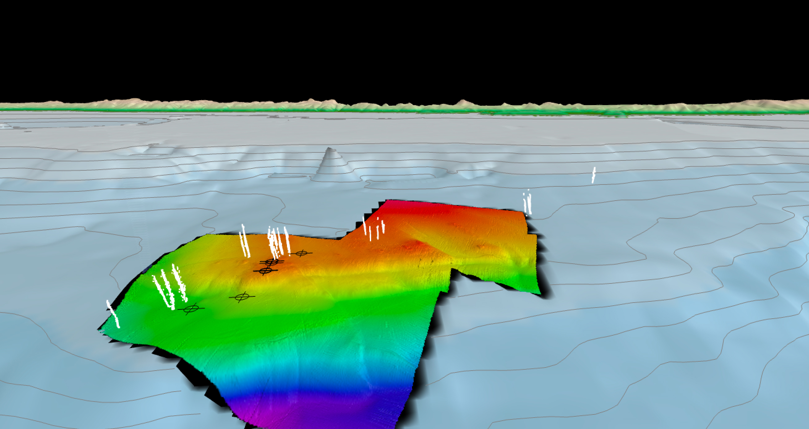
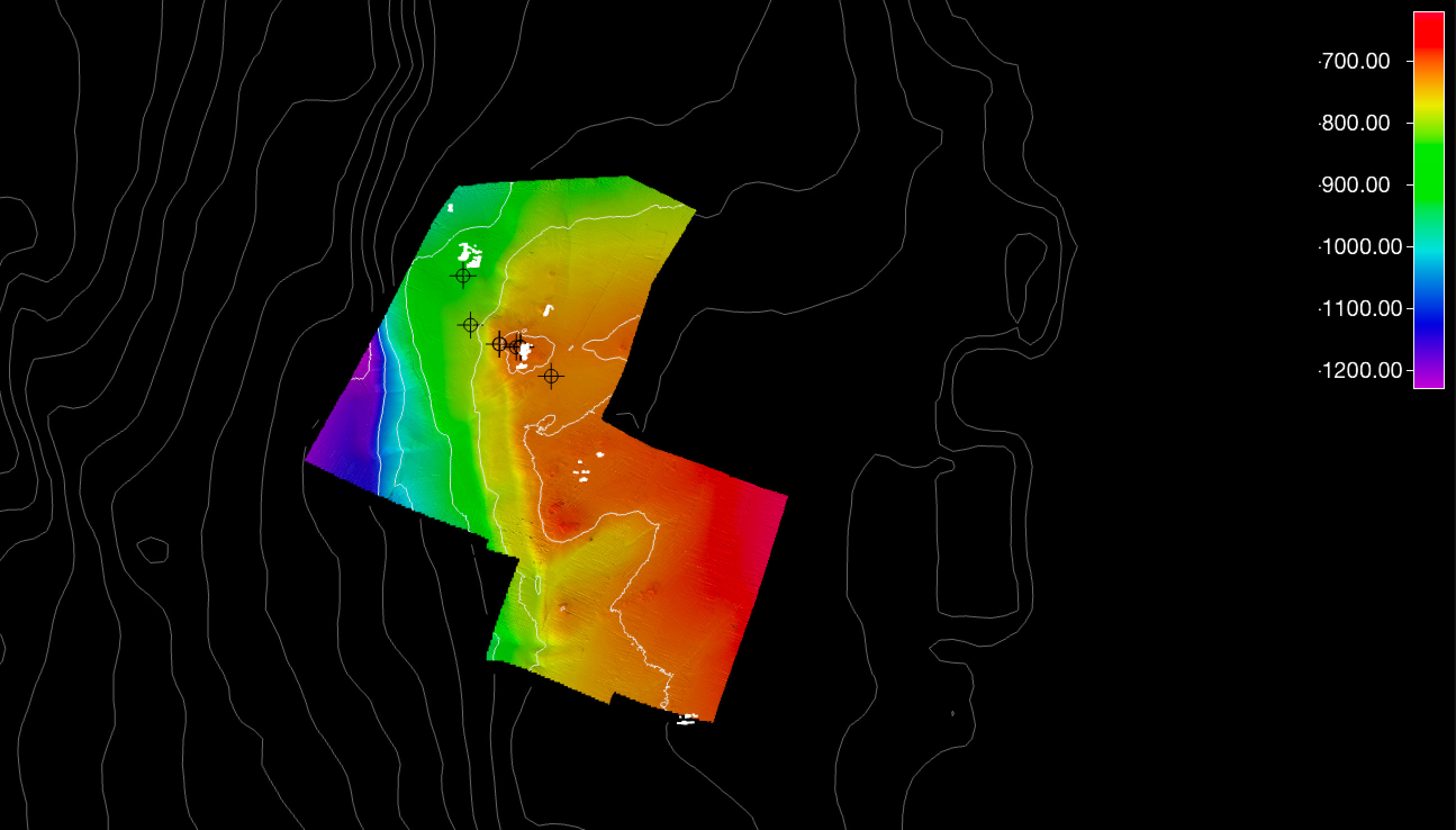
This project focused on mapping and characterization of methane seep ecosystems and their interactions with tectonic, climatic, and oceanographic processes along four key sites: Limarí Seeps, El Quisco Seep Area, Concepción Methane Seep Area, and Mocha Island Seep Area. Using advanced tools and techniques, the researchers surveyed the seafloor and subsurface structures.
- A high-resolution sub-bottom profiler was used to investigate the shallow subsurface structure of methane seepage. This state-of-the-art technology provided critical insights into the subsurface structure and geology while also informing the precise positioning of the sediment coring devices.
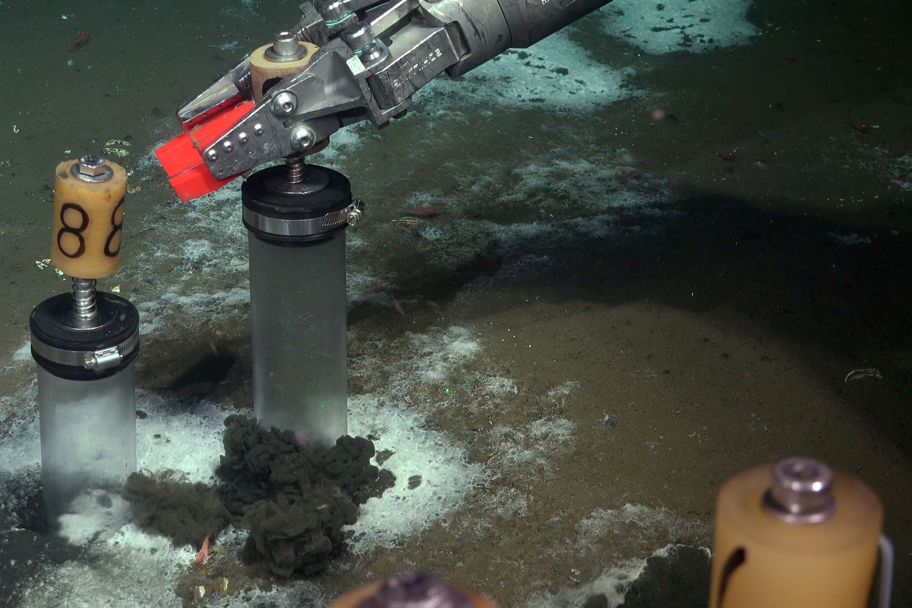
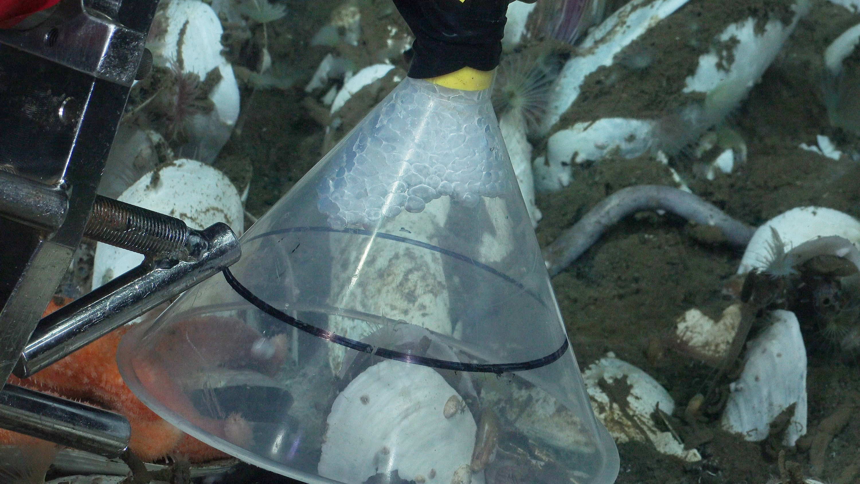
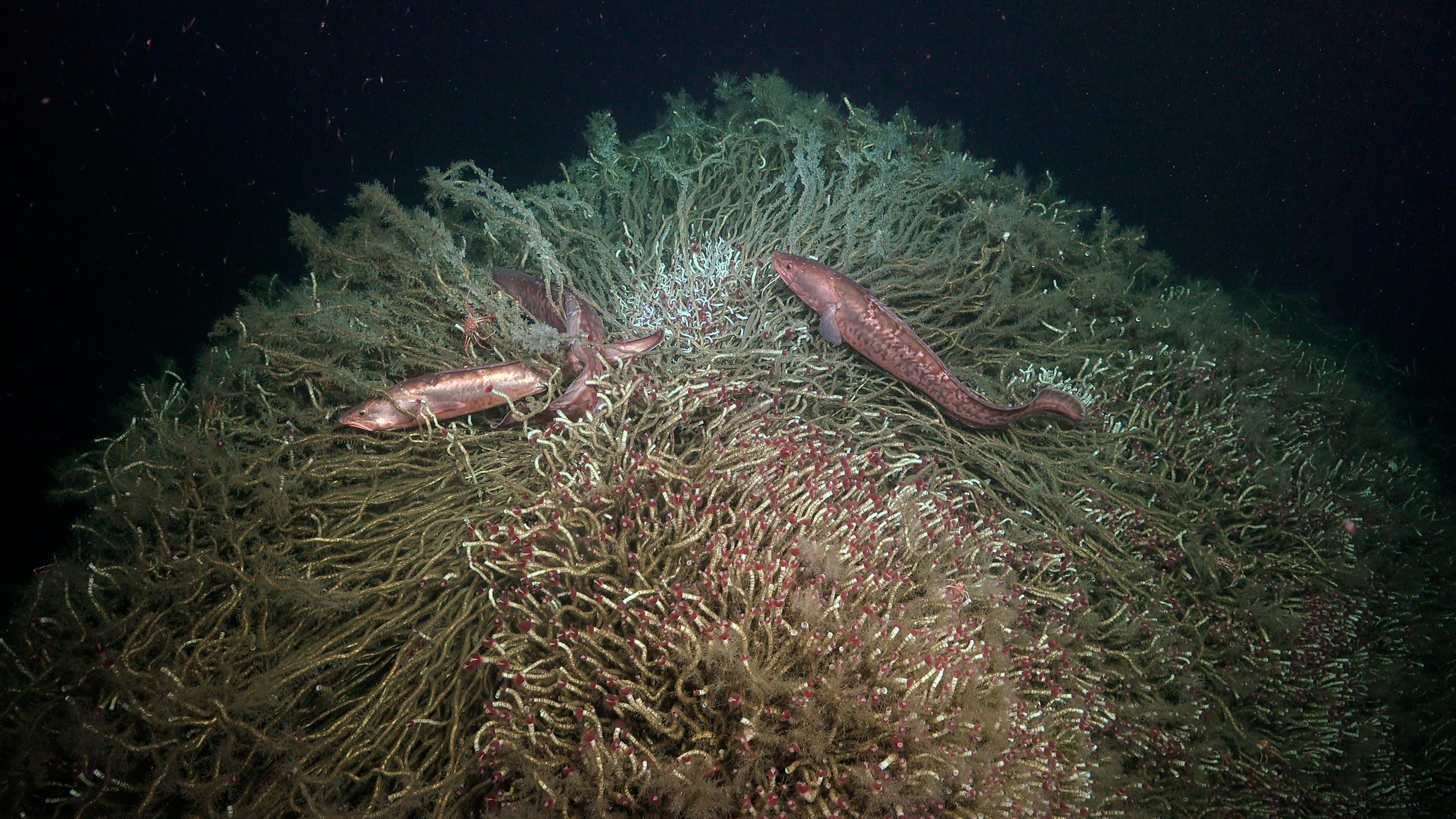
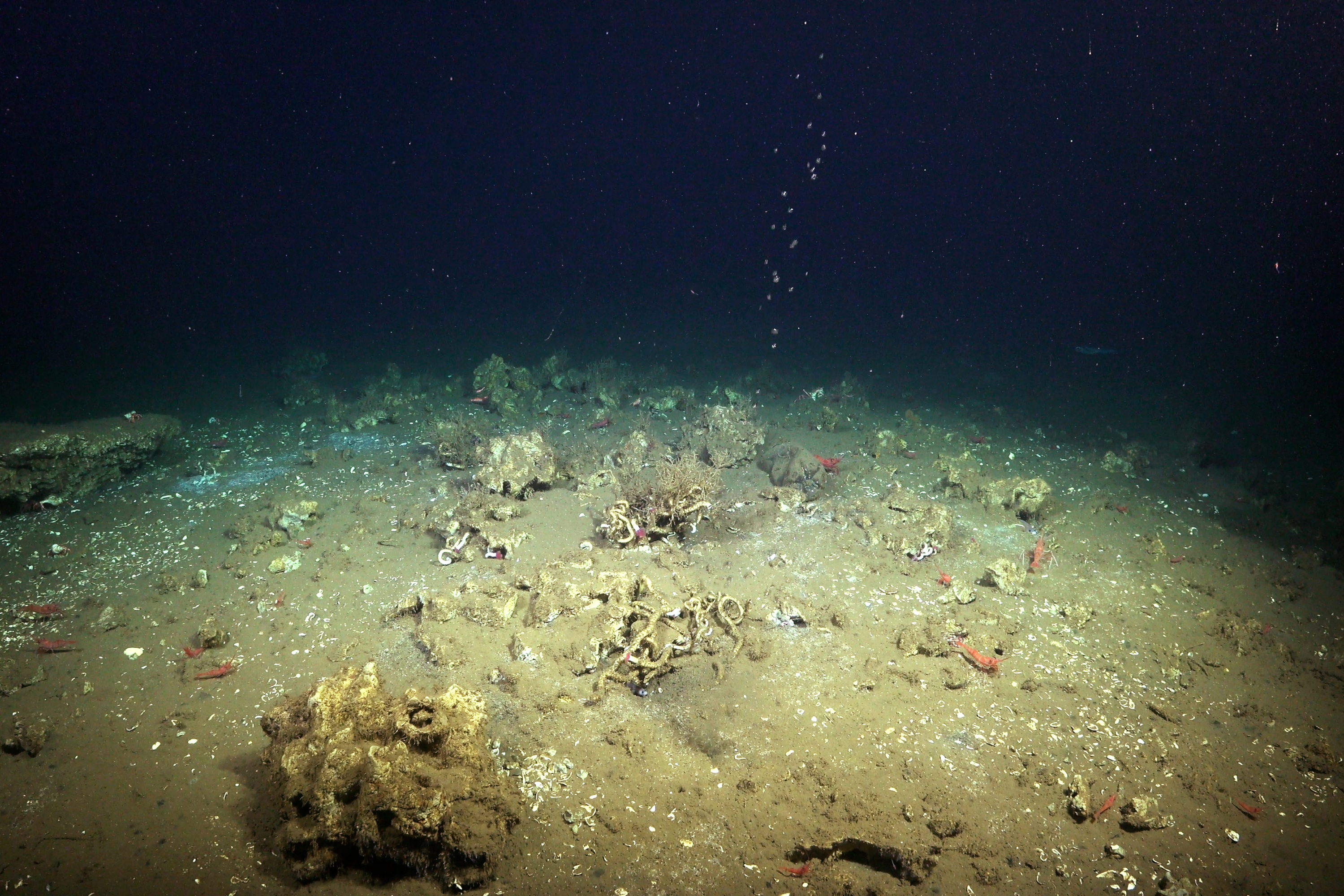
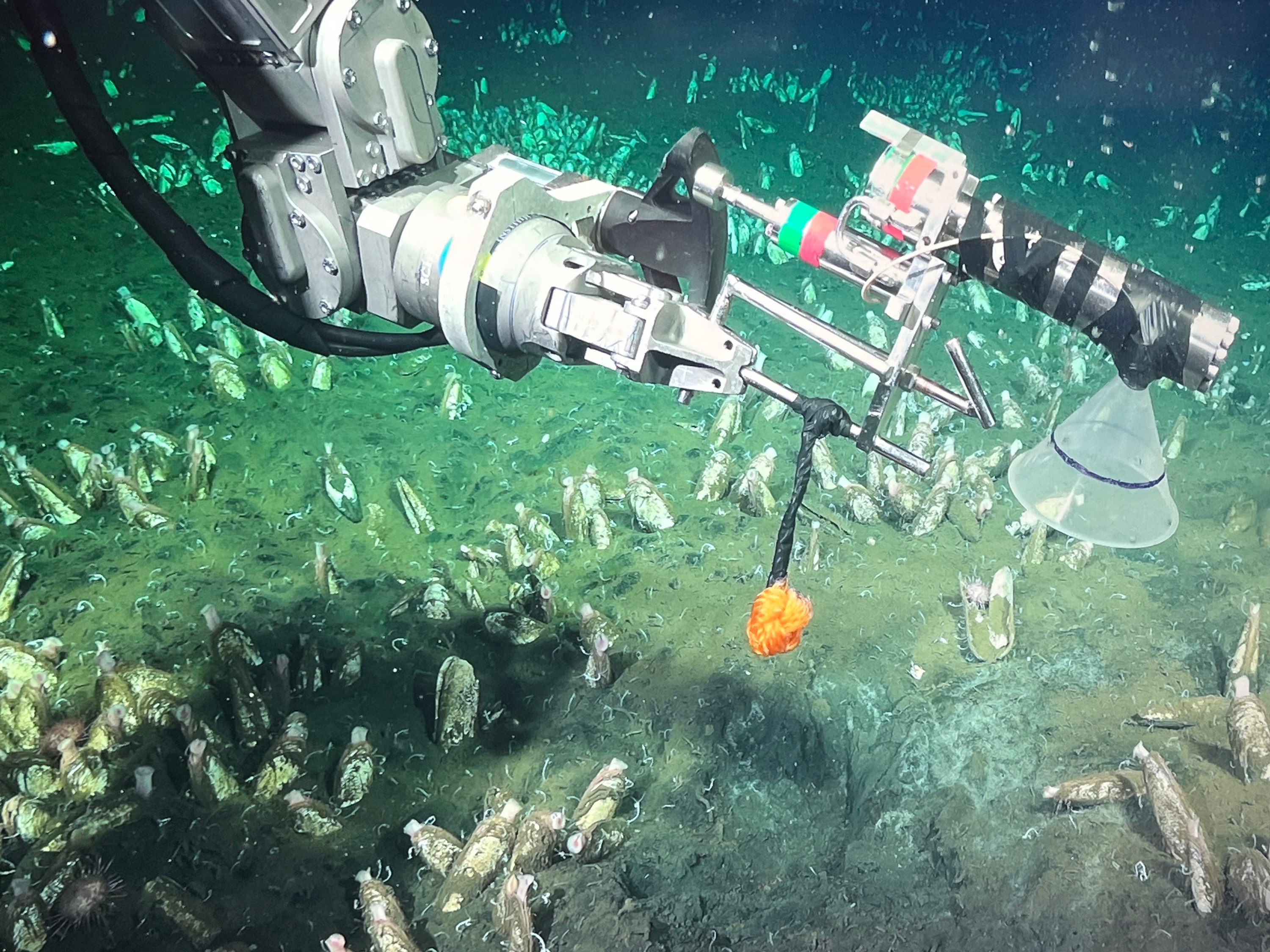
- Remotely operated vehicle (ROV) SuBastian was used for precise sampling and high-definition imaging of seep habitats. The ROV enabled the researchers to observe active methane emissions and collect samples from microbial mats and methane-derived authigenic carbonates.
- Geochemical sensors and samplers were used to collect data on methane fluxes, fluid migration pathways, and the geochemical characteristics of the seep environments. Among the sensors was an in situ methane sensor, now known as SAGE (Sensing Aqueous Gases in the Environment) used for precise and real-time measurements of methane concentrations in the water column developed with support from NOAA Ocean Exploration.
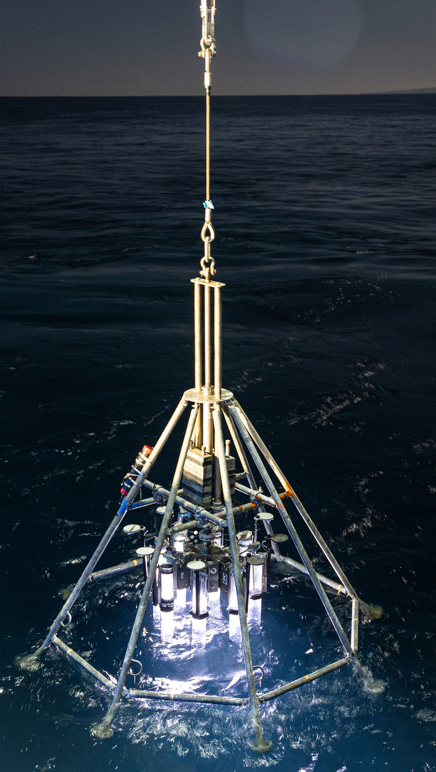
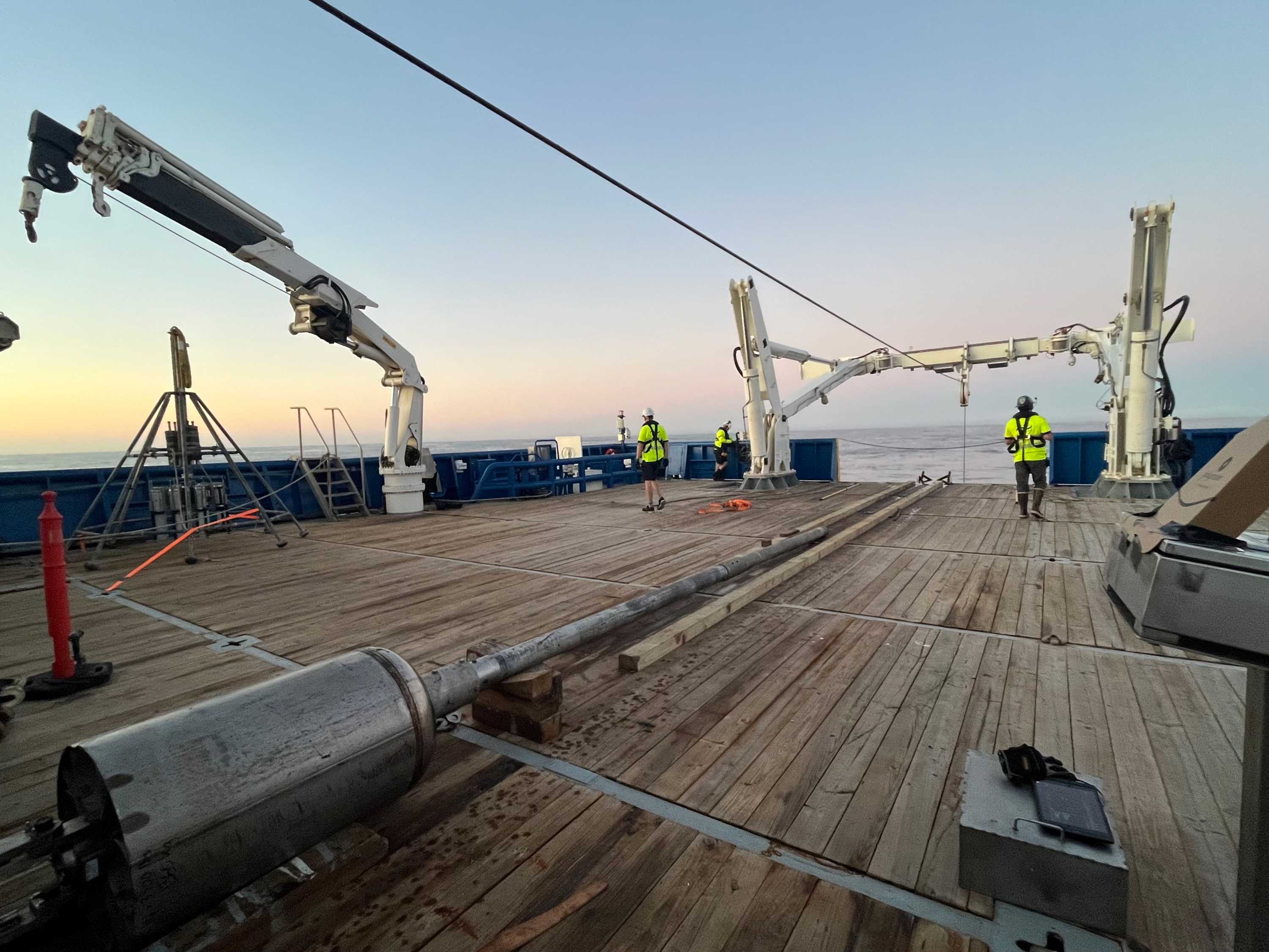
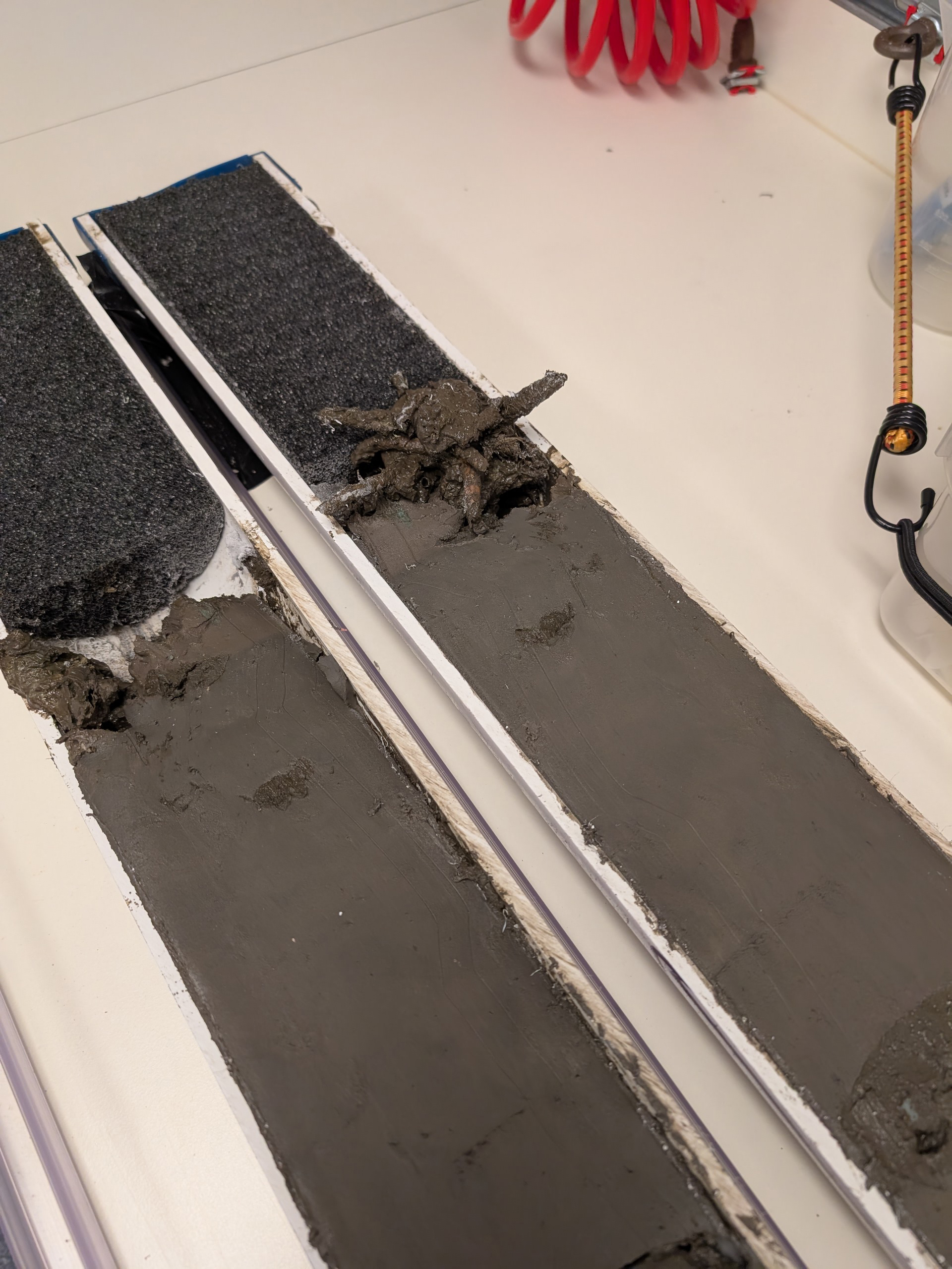
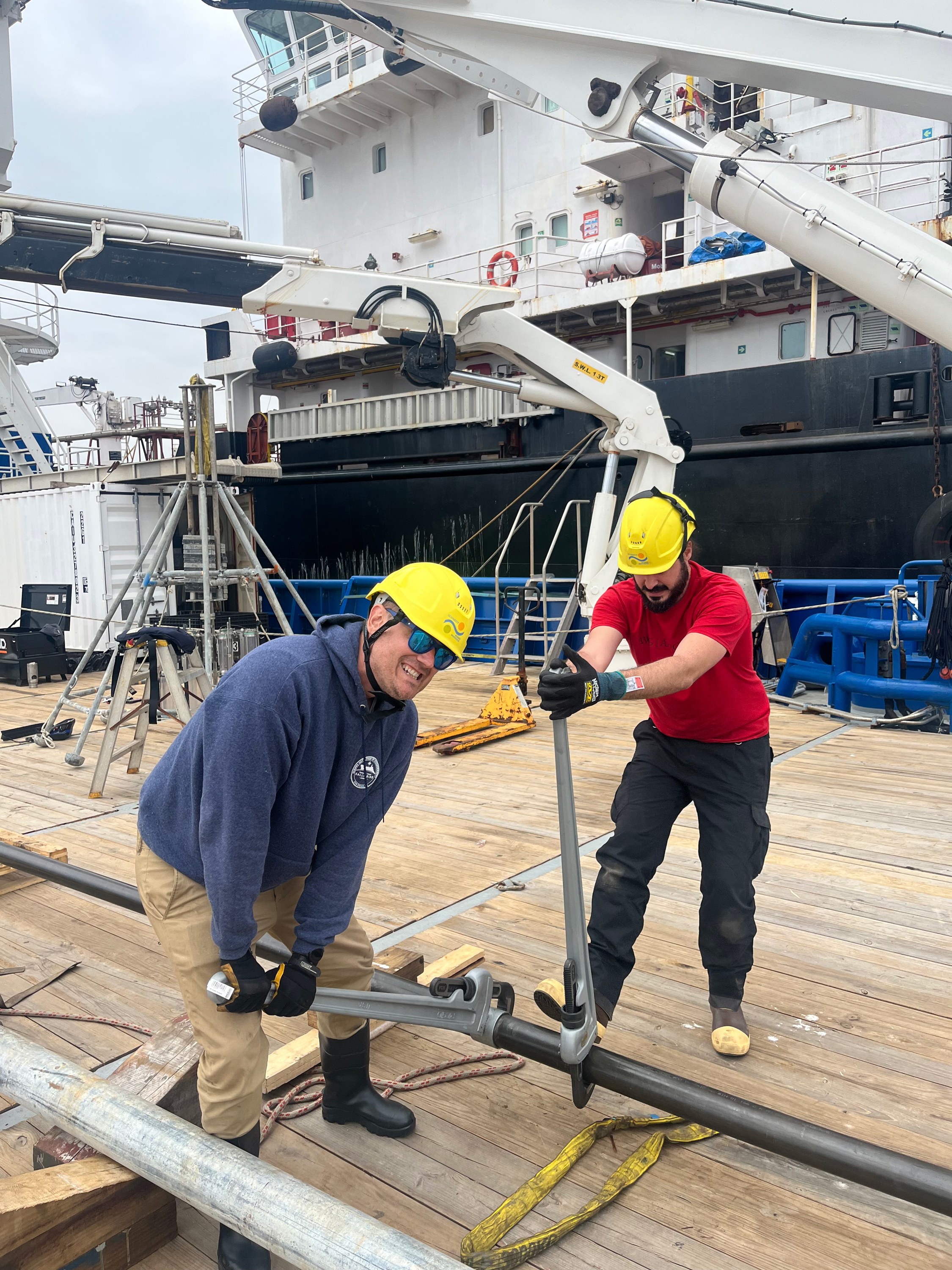
- Sediment coring devices were used to collect sedimentary records to reconstruct methane seepage history. This was the first time a large-diameter gravity corer that can collect samples up to 6 meters (20 feet) in length was deployed off Falkor (too).
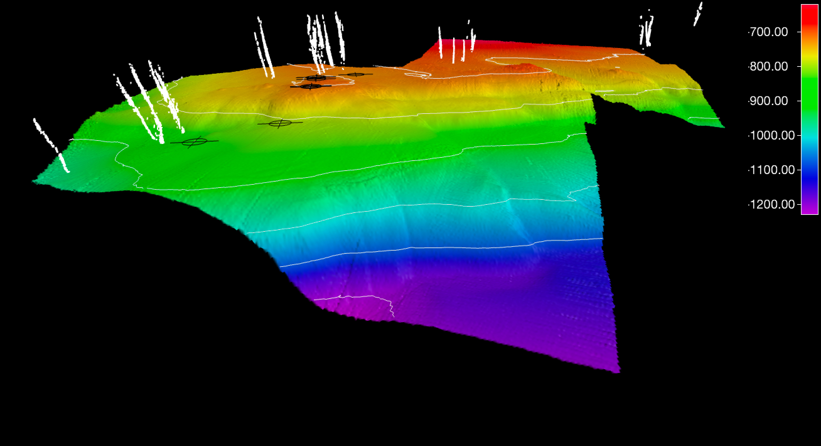
- Shipboard and ROV-mounted multibeam sonar systems were used to map the seafloor and individual seeps.
Accomplishments
While at sea, this project team:
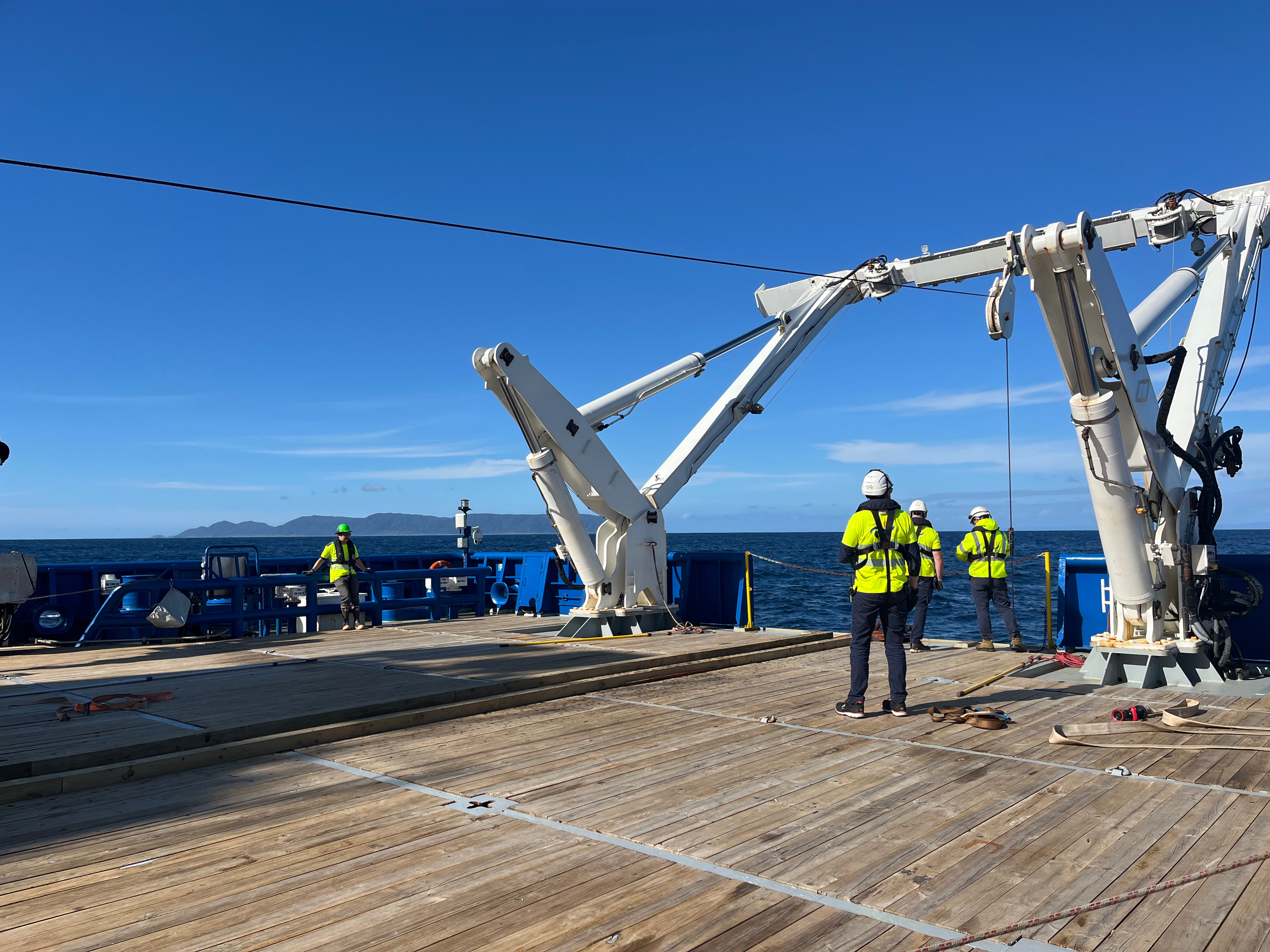
- Successfully and safely completed 22 total deployments of sediment coring devices (the gravity corer and a multicorer), providing valuable sedimentary records for methane seepage analysis.
- Mapped over 10,000 square kilometers (3,861 square miles) of seafloor, yielding insights into the region's underwater landscape.
- Conducted 23 ROV dives at methane seep and submarine canyon sites, significantly expanding the dataset of these dynamic environments.
- Mapped each of the four sites in high resolution (1x1 meter grid size) using the multibeam system on ROV SuBastian, providing precise visualization of seep features and habitats.
Next Steps
Back on land and in the lab, the researchers are analyzing collected data and samples in detail. They are integrating geophysical data with sediment and geochemical findings to model fluid migration pathways and reconstruct the history of methane seepage. They will share their results through peer-reviewed publications, conference presentations, and public data repositories.
Future work includes expanding methane seep investigations to other underexplored regions and developing predictive models for methane dynamics under changing conditions.
Images
Education Content
Education Theme page(s) provide the best of what the NOAA Ocean Exploration website has to offer to support your classroom during this expedition. On each theme page, you will find links to expedition features, lessons, multimedia, career information, and associated past expeditions.


Additional resources are available through the Deep Ocean Education Project, a collaborative effort of NOAA Ocean Exploration, Ocean Exploration Trust, and Schmidt Ocean Institute.
Related Links
Partners
- Cooperative Institute for Marine Ecosystem and Resources Studies (Jeff Beeson, project lead)
- NOAA Pacific Marine Environmental Laboratory
- Schmidt Ocean Institute
- The Marlow Lab at Boston University (Jeff Marlow, expedition chief scientist)
- Other Collaborators
Media Contacts
Emily Crum
Communications Specialist
NOAA Ocean Exploration
ocean-explore-comms@noaa.gov
This project was made possible through the support of NOAA Ocean Exploration, the NOAA Pacific Marine Environmental Lab, Schmidt Ocean Institute, and international collaborators. The interdisciplinary approach and cutting-edge technology deployed aboard Research Vessel Falkor (too) underscore the importance of collaborative efforts in advancing our understanding of deep-sea ecosystems and their role in the global carbon cycle.
Published March 24, 2025